This wild camping journey in Ben Alder Forest takes inspiration from Cicerone’s Scottish Wild Country Backpacking book. It starts from Dalwhinnie and takes in six of the area’s Munros: Ben Alder (1,148 m), Beinn Bheòil (1,019 m), Geal-chàrn (1,132 m), Aonach Beag (1,116 m), Beinn Eibhinn (1,102 m), Carn Dearg (1,034 m). A common approach to these hills is to cycle into Culra bothy and use the area as a base camp. I chose to do this as a loop, carrying my pack and wild camping along the way. As I had Lucky along, cycling wasn’t an option, so I walked the whole loop rather than cycling the first bit. If you do have access to a bicycle, I highly recommend using it for the 7km stretch out and back along Loch Ericht.
Ben Alder Wild Camping Map
Download file for GPSNote: This GPX file is based on my own journey and intended for inspiration only. Much of the route involves off-piste terrain and will no doubt differ significantly from your own track. Always carry a map and compass and know how to use them!
Also FYI: This post contains affiliate links. If you make a purchase through one of my links, I might earn a small commission. Thanks for supporting the journey!
Trip Essentials
- Starting / Finish Point: Dalwhinnie – Free parking near the railway bridge. (View on Google Maps)
- Total Distance: ~62 km
- Total Ascent: ~2750m
- Terrain: Excellent cycle-able tracks on the approach, then a mix of good paths, off piste sections through bog and heather, and some easy scrambling on Ben Alder.
- Maps: OS Landranger Map 42, OS Explorer Map OL50, or Harvey Ben Alder Superwalker map XT25
- View on OS Maps
- View this route and more in our Interactive Route Map
Field Notes from Ben Alder
Day 1: Dalwhinnie to Geal-chàrn (Almost)
It was an early but late start. I had planned to leave the day before and have a van night nearby, but I was wooed by a Saturday night at home with the family unit. I value that time as much as my solo adventures, so there is always this internal conflict with leaving the home base. (I’ve even been known to postpone trips for days because I was too busy enjoying home time — surely a sign I’m very lucky.)
So I made an early start from home. I was off at 6am for the 3.5-hour drive to Dalwhinnie, stopping at the Newtonmore Co-op for extra provisions (mainly sausage rolls for Lucky and my traditional camp avocado). (I wished I’d had time to stop at the Newtonmore Grill for a coffee!)
It was a beautiful clear sky Sunday, so no surprise there were lots of people about. I felt fortunate to get a spot at the little parking area by the bridge.
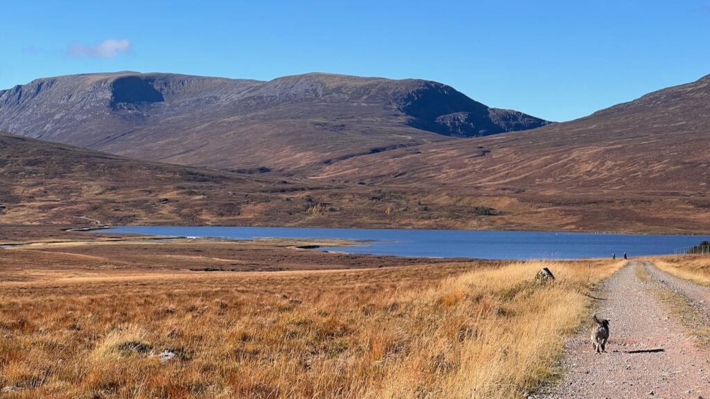
The first stage of the journey is a 7km, two-hour road walk along Loch Ericht — a quiet road, but still, boring. You can see why I recommend cycling this part if you can! I would have done so, but I wanted Lucky along. The track leads to the ostentatious Ben Alder Lodge via several similarly ostentatious “follies” (fancy holiday homes).
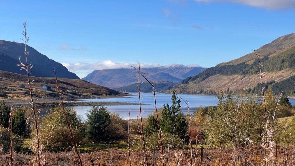
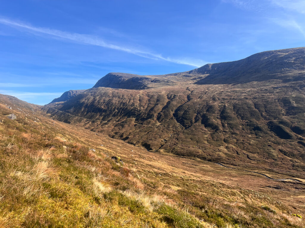
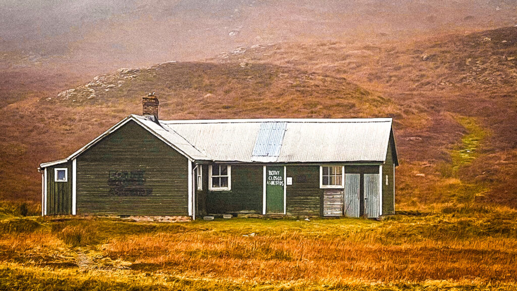
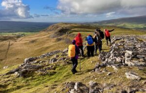
Many people come here to walk to Culra bothy, a hut in a sensational location below Ben Alder and the other Munros. It is the starting point for the usual walks up these remote hills. Many use the bothy as a base, either to camp or stash their bike, before heading to the hills. However, there’s no sleeping in the bothy as it’s been closed for years due to asbestos, though it is set to be rebuilt this year according to the Mountain Bothy Association. From the track, you can see Culra in the distance (just visible in the middle of the photo below). However, my journey was taking a different approach, and I wouldn’t pass Culra until Day 3.
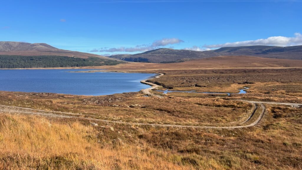
From there, the track continues west towards Loch Pattack (which in my head I pronounced as the Klingon curse word p’tak). More tracks, more bicycles. It began to feel wilder as Ben Alder and its neighbours started to dominate the skyline. It struck me as a spot that would be great for cycling and camping.
Due to my late start, I felt under time pressure all day, which was annoying. I hadn’t started walking until almost 11am and knew I had over 20 km and 1000+ metres of ascent to cover. How slow would I be? Given my usual tendency to carry a stupidly heavy bag — this time weighed down with three days’ worth of sausage rolls and other treats for Lucky (and an avocado treat for me) — I was determined to reach our planned camp before sunset (~6:30pm on this balmy October Sunday). This made me obsessed with my pace and reluctant to take long stops. Lunch was a quick focaccia, hummus, and sprouts before the real climb began.
There was nothing technical about the journey — just a pathless hill of heather and bog to negotiate. After the road walk, this too felt boring. The sun was in my eyes, so I spent much of the time looking at my feet.
After about 1.5 hours, I reached the 827 m spot height with much relief. The going after that was less mentally challenging thanks to the presence of a path and the sun now lower in the sky. I was also feeling more relaxed about the timing — I felt pretty sure I’d make my sunset goal.
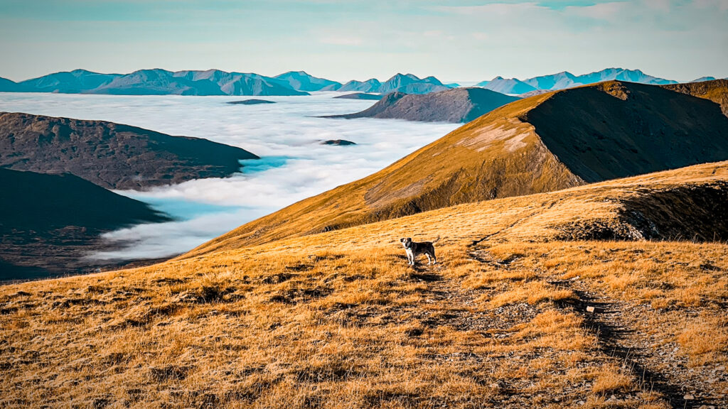
Carn Dearg (1,034 m)
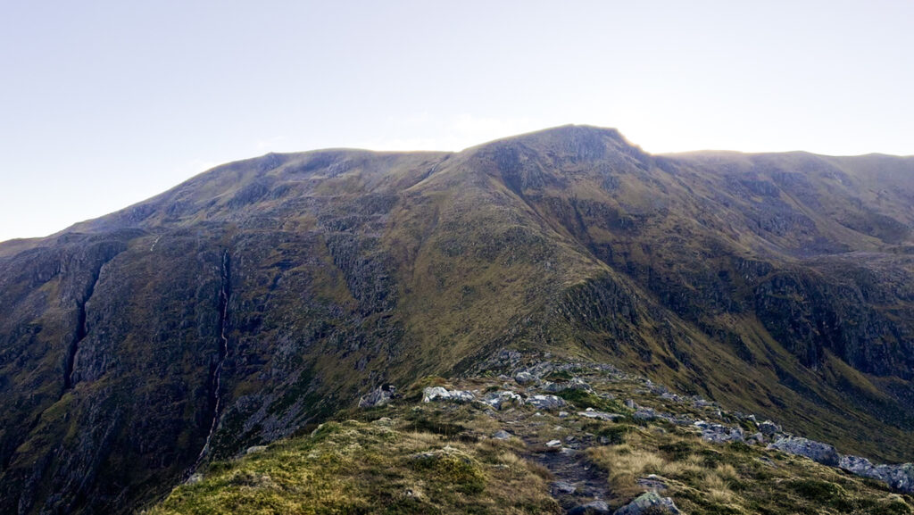
One last pull brought me to Càrn Dearg (1,034 m), the only Munro of the day — challenge enough! It was a broad, flat top with a little shelter, unneeded on this unseasonably warm day. I took a moment to enjoy the views behind me — back towards Loch Pattack and the hills of Dalnaspidal Forest.
The end was in sight. From there I could see the Geal-chàrn plateau where I planned to camp, along with its welcoming spring, visibily pouring down the mountainside. Between me and that was a small hill and an imposing-looking ridge, which turned out to be steep but easy with a good path.
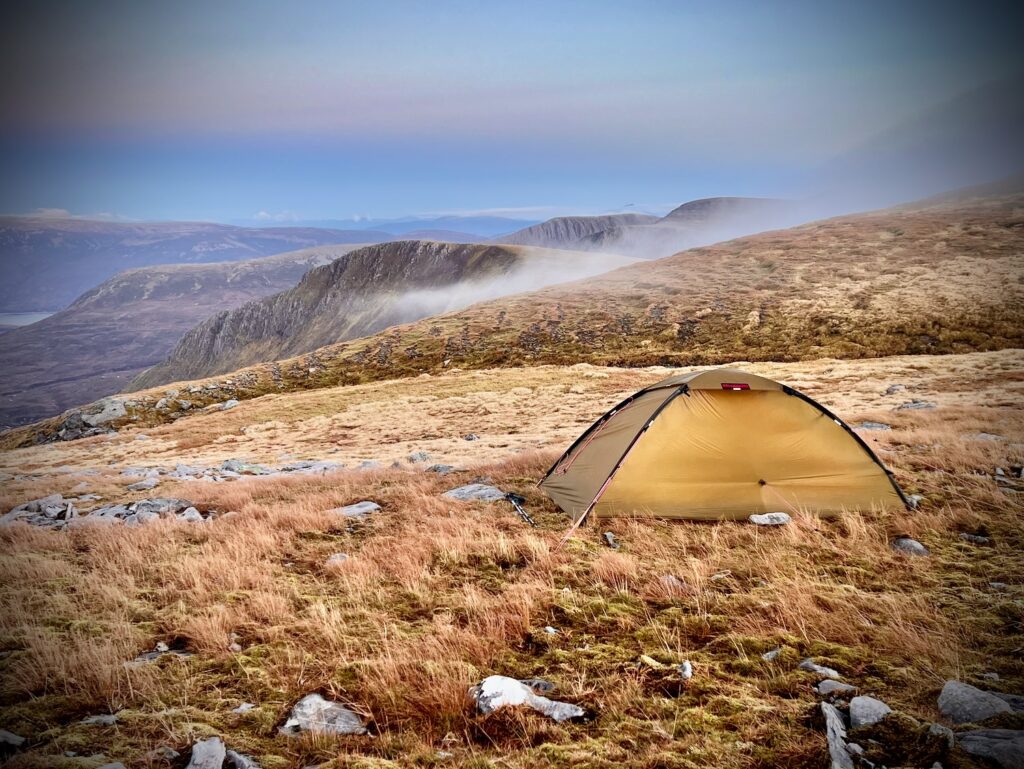
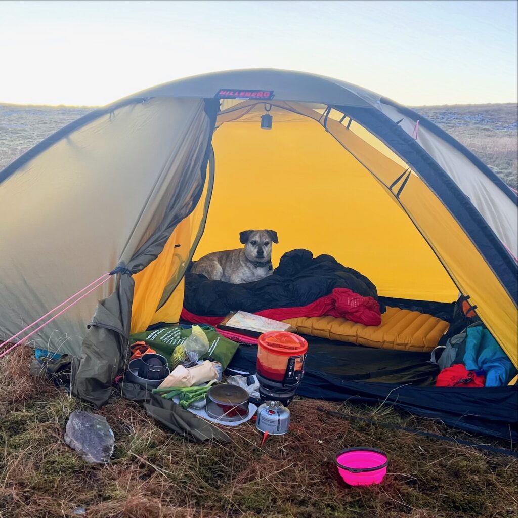
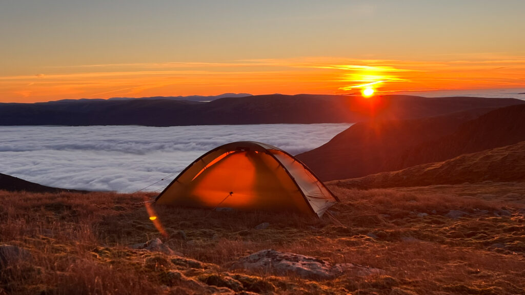
I arrived at camp around 6pm and had to remind myself how to set up the Unna as the mist came in.
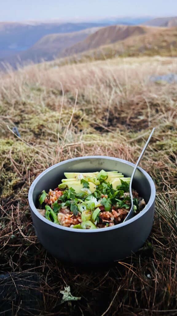
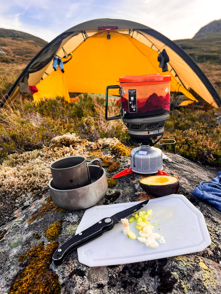
I fed Lucky, then made jambalaya with chorizo, avocado, parsley, spring onion, lemon, and salsa macha — a triumph of a camp dinner.
Overnight the mist cleared. The MWIS teased me with forecasts of inversion conditions on the following day. The only thing left to do was sleep as soundly as possibly and see what the happens!
Day 2: Geal-chàrn To Below Ben Alder
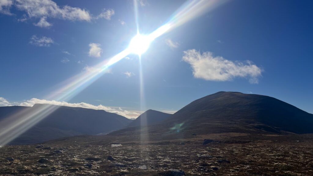
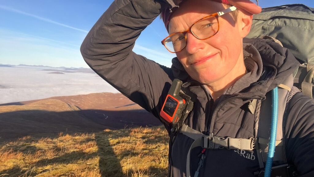
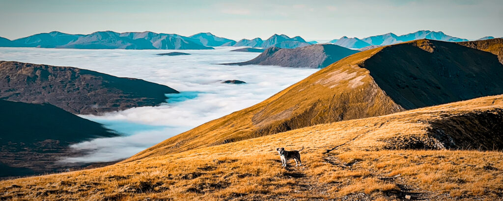
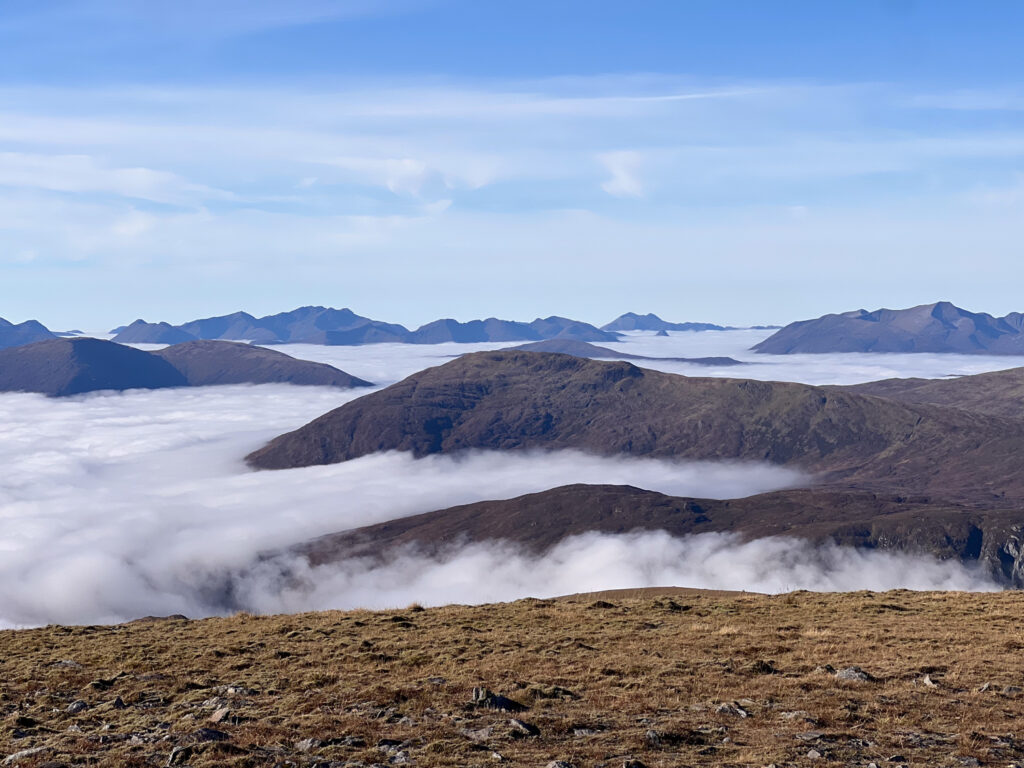
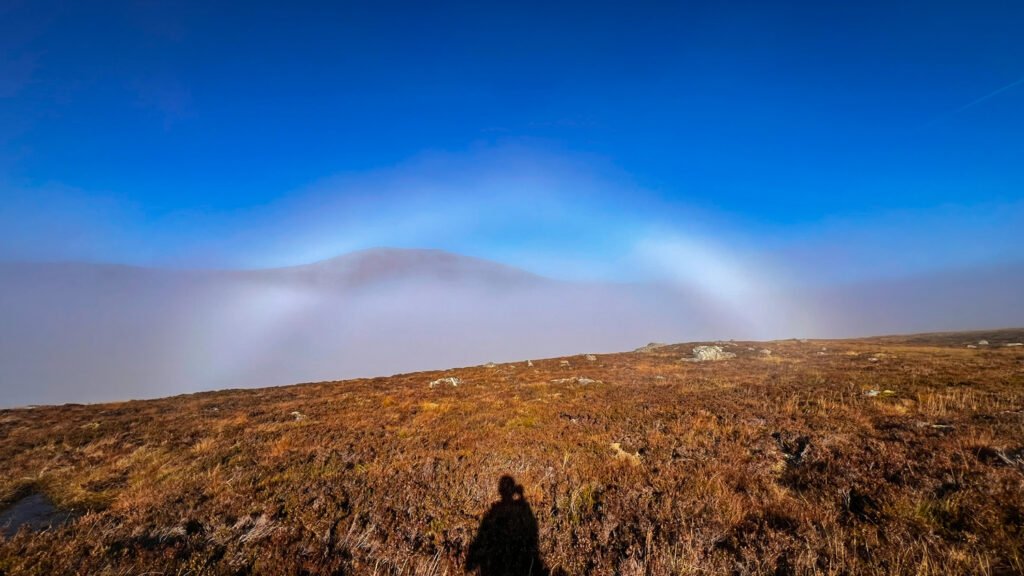
It was a shorter day but it felt long. I woke up to spectacular inversion conditions — honestly some of the most sensational I’ve ever witnessed. I was glad to be up early to watch it emerge as the sun rose.
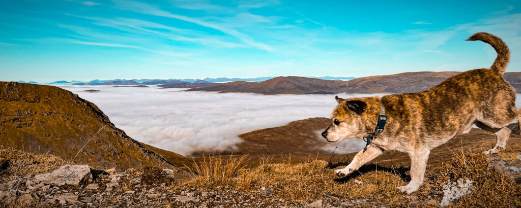
We set off for the three Munros of the day – Geal-chàrn (1,132 m), Aonach Beag (1,116 m), Beinn Eibhinn (1,102 m). It was quick work, but we lingered plenty and took far too many photos (I knew they’d overwhelm me later).
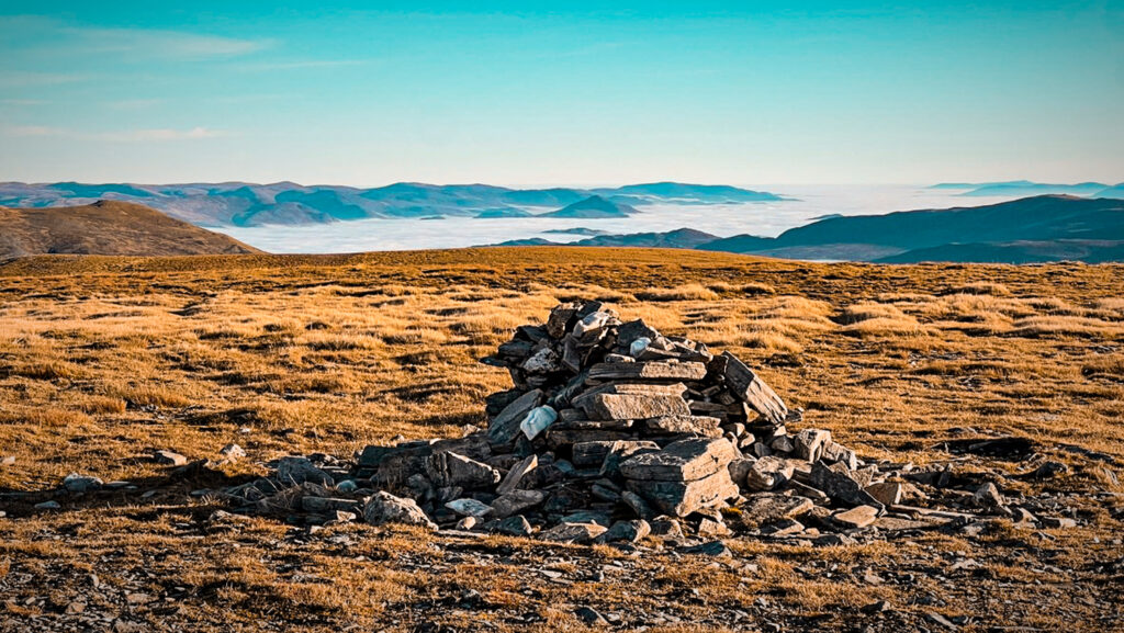
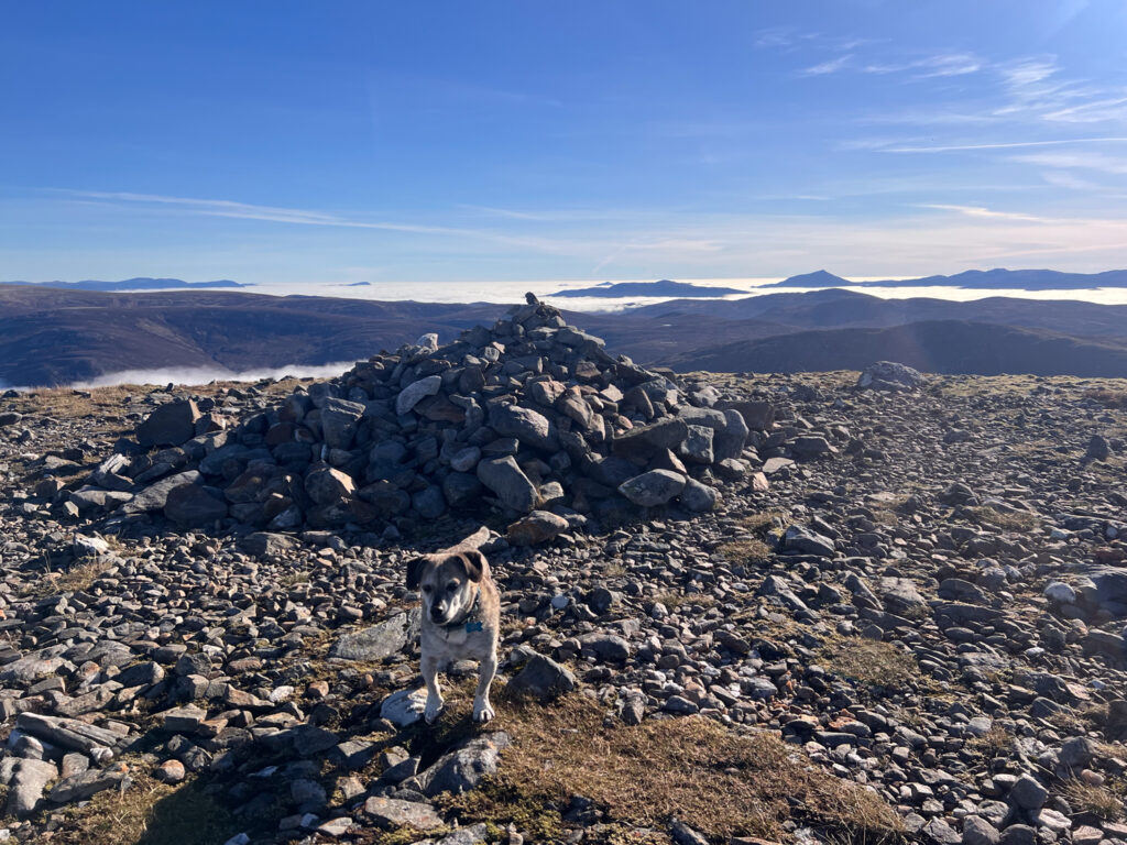
Geal-chàrn (1,132 m)
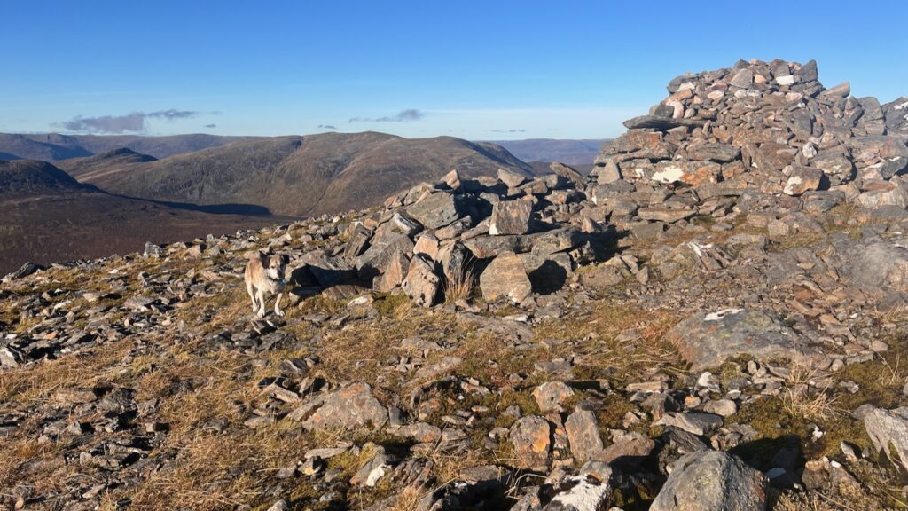
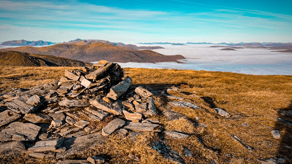
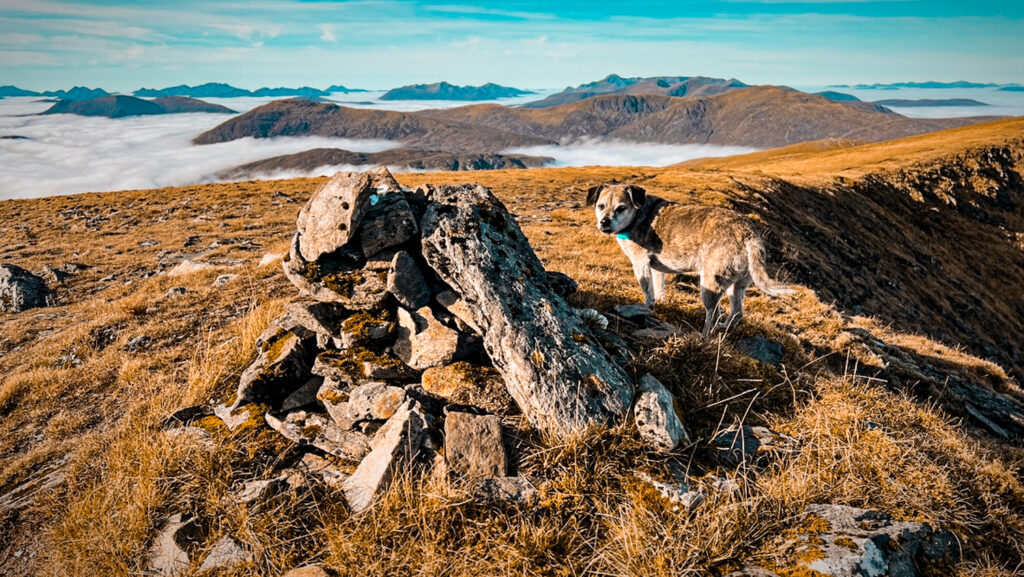
Geal-chàrn was a short jaunt from camp up and the start of a litany of awesome views and excessive camera snapping. The summit is a broad plateau, marked by a cairn.
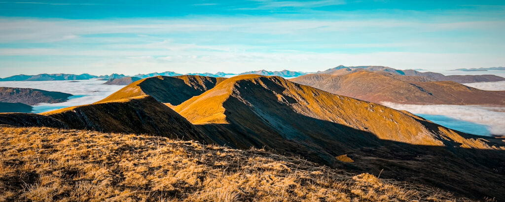
Aonach Beag (1,116 m)
The onward journey to Aonach Beag was a delight.
I left my bag in the Bealach between Aonach Beag and Beinn Eibhinn, a welcome lightening of the load for the there-and-back journey to this final Munro of the day.
Beinn Eibhinn (1,102 m)
Journey to camp below Ben Alder
We were off the hill before noon, descending from the beallach where I’d left my bag. It felt a shame to go, but the timing was right. The time was just after mid-day and the sun made things trying. It was unseasonably hot, t-shirt weather, but this is the nature of inversion conditions – warmer, lighter air above the cloud (learn more about how cloud inversions work).
The onward journey followed a slog downhill through steep, uneven ground to reach the blissful Bealach Dubh. This pass between Ben Alder and Aonach Beag has the benefit of a very good track.
My original plan had been to camp near the lochan in the hanging corrie formed by Ben Alder and Beinn Bheòil, then climb Ben Alder via the “Short Leachas” — a stubby ridge extending east from the mountain. It’s a Grade I scramble, described in the Cicerone guide as “giving one or two exposed steps and a small wall which is a little exposed but offers plenty of holds.” I decided this was perhaps too big an undertaking for my short-legged friend, so we camped instead in a spot more convenient for the usual route up the “Long Leachas” — also a Grade I scramble, but with very little difficulty and no exposed walls.
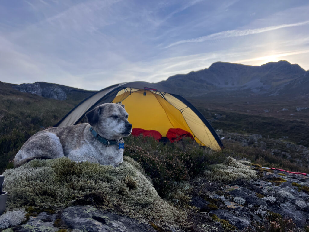
The ground around Allt a’ Bhealaich Bheithe isn’t ideal for wild camping – lots of steep heather and potential for bog – but we found a flattish heather patch near some boulders. with big mossy rock to spread out on (Lucky and I both took full advantage).
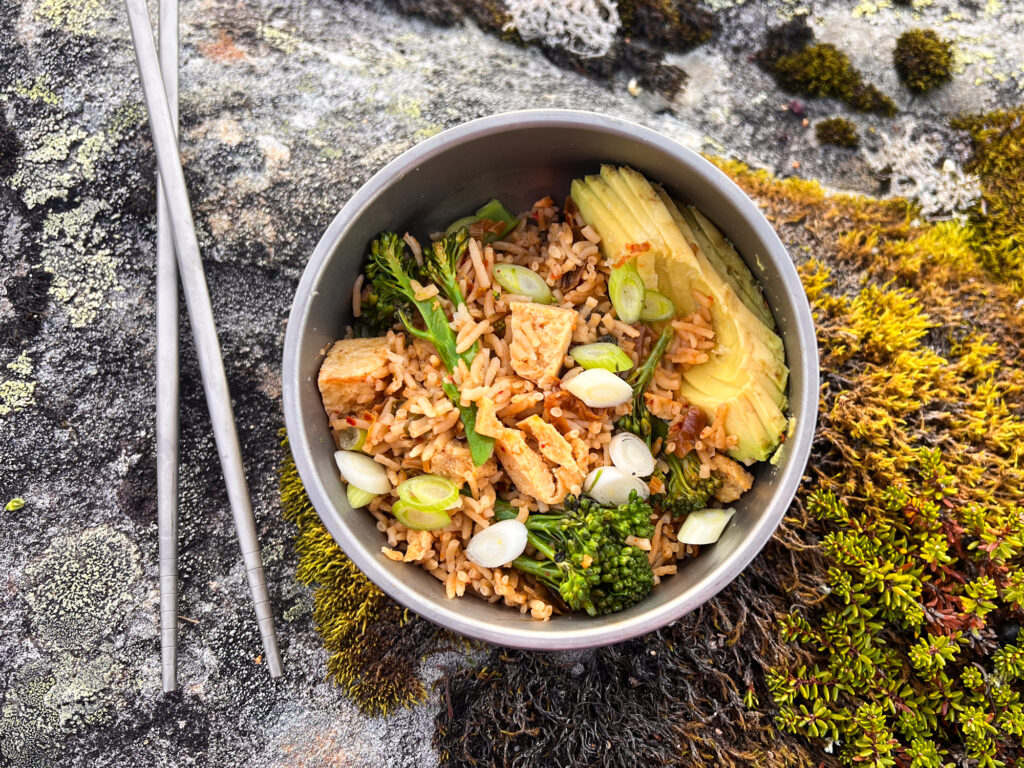
Dinner was kimchi rice with tofu — another triumph! I added avocado, spring onion, and broccoli, with leftovers packed for lunch the next day.
Reflecting on the day, it occurred to me that I’d felt rushed for most of the trip. I found it hard to relax — constant time analysis, fear of the unknown. This was a pretty ambitious hike and I wondered , why was am always chasing these mountain epics? Don’t get me wrong, was having a great time, and so glad I got to experience these hills in such outstanding conditions. But I also promised myself to plan some future trips that were a bit, well, simpler.
This simplicity is one of the other reasons I picked this spot to camp, as it would allow me to leave the tent and gear behind for the hike up Ben Alder. A blissfully light and fancy-free mountain day awaited! The only thing casting a shadow was the onward mission from Ben Alder, a near-20 km walk back to the van — a boring stretch that possibly explained some of my lingering anxiety (dread?). This was mostly abated by hot chocolate and a bit of Duolingo!
Day 3: Ben Alder and the Long Journey “Home”
A long day!


I woke up in the dark under the stars and moon, with Jupiter shining as its neighbour. Down in the valley below, I could see a sea of cloud — conditions were clearly right for another beautiful day above a cloud inversion. Carpe diem!
We left camp just before sunrise to head up Ben Alder. I had pitched the tent near the river crossing point for the usual loop up Ben Alder — a spot that justified leaving the tent and heavy gear in place while I tackled the hills with a lighter pack. This ended up being 100% the right decision.
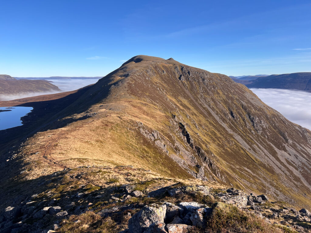
Ben Alder (1,148 m)
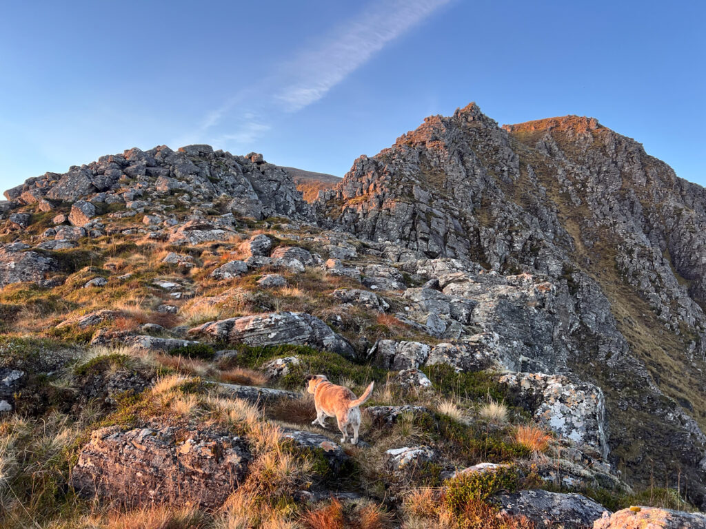
We began our ascent of the Long Leachas as the sun rose over the opposite hillside, casting a golden glow across Ben Alder. The ridge looks intimidating from below, but up close it’s much friendlier. There’s a clear path most of the way, and any scrambling is brief and straightforward. I may have said differently if I’d been hauling my heavy pack, but with such a light load, the climb felt almost blissful. We arrived at the top of the plateau and made for the summit in that beautiful morning light.
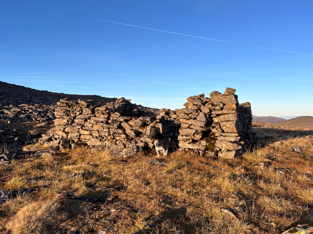
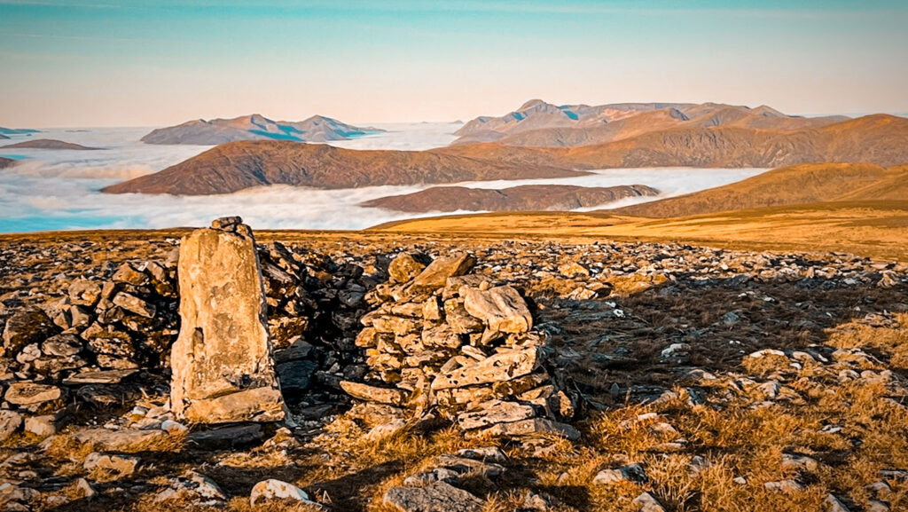
Just below Ben Alder summit are some intriguing stone enclosures — the remains of a 19th-century “Colby Camp,” used by Royal Engineers during the first national triangulation of Britain between 1818 and 1852. These teams, under Major-General Thomas Colby, built temporary stone shelters near the summits while using massive theodolites to sight distant peaks. Ben Alder was particularly important, serving as an Ordnance Survey “origin” point for mapping Inverness-shire at large scales.
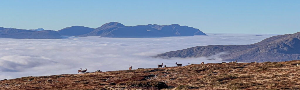
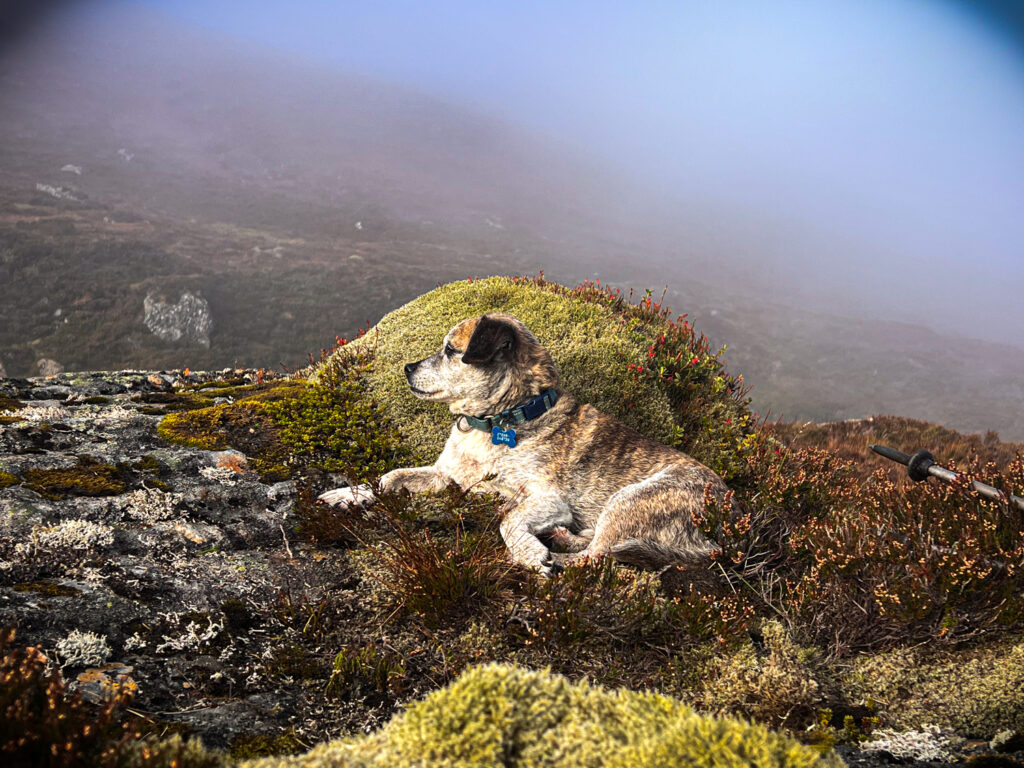
From the trig point at Ben Alder, the route follows the edge of the corrie to the east. It then drops steeply south over boggy, rocky ground to Bealach Breabag. Roaring stags were everywhere — not just here in the bealach but all over the hills throughout the trip, constantly visible and making a huge racket. (October is red deer rutting season, when stags roar to attract females and warn off rivals.) Fortunately, Lucky paid them little attention. Or perhaps he’s simply accepted by now that catching one is out of the question.
Beinn Bheòil (1,019 m)
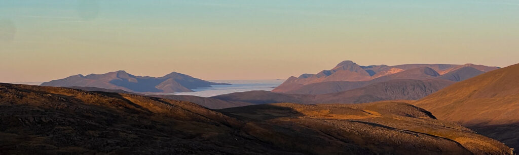
From the bealach, a clear path climbs to Sròn Coire na h-Iolaire and onwards to Beinn Bheòil (1,019 m) — the last of the six Munros of the trip! It was nearing noon, and the heat of the sun felt absurd for mid-October. But this stretch was pure joy — the satisfaction of accomplishment, the view back to Ben Alder where I’d just been, and yet more beautiful inversion layers, this time stretching towards the Cairngorms.
We took a long break on Beinn Bheòil for lunch — kimchi rice leftovers, which I’ll say again, absolutely rocked my world — before gearing up for the downhill journey back to the van.
First, though, I needed to collect the tent and gear. The descent followed the ridge north, then dropped steeply west towards the river where we’d camped.
By the time we got there, the cloud base had risen, and the tent was now sitting in mist. Lucky took a nap while I packed up camp and prepared for the final leg. The walk ahead wouldn’t be difficult — clear paths, mostly downhill — but it would be long (around 20 km), so the mental battle was real.
The first stage had enough interest to keep me going. We’d camped near the main Ben Alder path, which joins a very well-kept stalker’s track. After a few kilometres, we passed the (in)famous Culra Bothy — closed since 2014 due to asbestos but reportedly being rebuilt in mid-October 2025, according to the Mountain Bothies Association (though I saw no sign of work on 15 October 2025!).
The path eventually rejoined the estate track on Ben Alder Estate, and suddenly I was back on familiar ground. It was much quieter than when I’d left on Sunday — the weather at this level was misty, it was midweek, and the throng of weekend cyclists had vanished. I was now about 10 km from the van and back in phone signal. I’d packed headphones specifically for this stretch, alternating between podcasts and voice messages to friends to keep my spirits up. The only real challenge now was that my feet were aching — mountaineering boots aren’t exactly designed for pounding along paved roads. But foot care is a story for another day. We were back at the van by 5pm in time for a trip to the shops and a park up at one of my favourite spots near Newtonmore. I even had a bit of energy left to write up these notes!
Gallery


")


Further Reading
A similar but different approach to these hills can be found on Steve Fallon’s website: Ben Alder Forest Munros.
You can find more epic mountain journeys like this one in Cicerone’s Scottish Wild Country Backpacking book.
 Dehydrated Mexican Rice Recipe (Arroz Rojo for Backpacking)
Absolutely epic!