
I’ve written before about wild camping around Breabag. This different route was a chance happening thanks to a visit with friends Charlie and Aileen from my Wiltshire days. We took the opportunity of having two cars to start in Inchnadamph and finish at the Bone Caves car park. The journey looks relatively short on paper, but the off piste terrain around Breabag combined with our laden packs (turns out we were all heavy packers) made for a great challenge. You can see from the map below that we skirted under Breabag and bypassed its main summit, but you could easily extend this to reach those heights if peak bagging is on your list.

Trip Essentials
These are my personal notes with GPX data taken from my own journey, tracked with a smart watch. I’ve provided this to give you some inspiration for your own journey, not as a rigorous guide (these routes often involve off piste sections, in which case your gpx data may look quite different!). If you’re heading to the hills, make sure you or someone with you has solid map reading and navigation skills. You’ll find links below to relevant maps and resources to help you plan your own adventure.

- Starting / Finish Point: Start at the Inchnadamph car park and finish at the Bone Caves car park
- Total Distance: ~13 km
- Total Ascent: ~690m
- Terrain: Decent tracks to start and finish; entirely off piste between the top of Gleann Dubh and the bone caves with some heather, bog, and rocky sections.
- Maps: Assynt & Coigach Harvey Map
- View GPX on OS Maps
- View this route and more in our Interactive Route Map
Field notes from our Breabag adventure
Much discussion was had before leaving about the weight of our packs. Mark was intent on taking some camera equipment. I decided it would be a good idea to take leftovers from our Indian feast on the night prior, rather than ultralight dehydrated meal options. All of us had heavy four season tents on board. We did the math and all of us were carrying 13-17kg of gear each. Far from ultralight! But at least we knew we’d all be slow. And indeed setting off from Inchandamph at around 2pm, I could feel my legs burning, and wondered a bit if that large portion of dal I’d packed was over the top. The route up Gleann Dubh (“black glen” or “dark valley”) towards Ben More Assynt is thankfully straightforward with a good path and super views of the “Big Assynt Mountain”.

We decided to call it a day just a couple hours later, towards the top of Gleann Dubh on a flattish spot near the water. Charlie said it was the most magical place he’d ever spent in a tent!


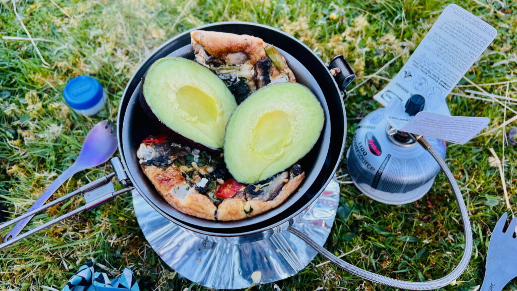
Mention must always be made of the food, and on this occasion, I brought all but the kitchen sync. The dahl and rice pulau that weighed down my pack was enjoyed for dinner that evening. Breakfast was another hefty number – leftover frittata, avocado, and slices of the life changing loaf of bread. I discovered that using a double boiler technique worked well for reheating the frittata and taking the chill off my avocado.

The going was easier on day two, well-nourished with lighter bags and quality sleep (despite pitching on a subtle incline that saw us wake up in the middle of the night halfway down our sleeping mats).

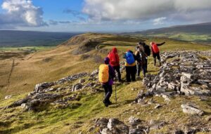
Leaving camp, we set off towards the bealach, Breabag Tarsain, also frequented by folks walking the Cape Wrath Trail. Intermittent boulder fields and stream crossings made the going very slow. This allowed for lots of good chatter along the way and plenty of stops for pictures and snacks.

We opted against going to the true summit of Breabag, just to save our legs and avoid a late finish. But that didn’t spoil the views.
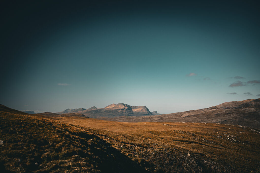
Breabag isn’t often visited but the scenery here is as spectacular as ever – you get to see all of the iconic Assynt mountains all lined up in a row.
Further reading:
Breabag Wild Camping Gallery


 Tortilla Soup with salsa macha
Leave a Reply