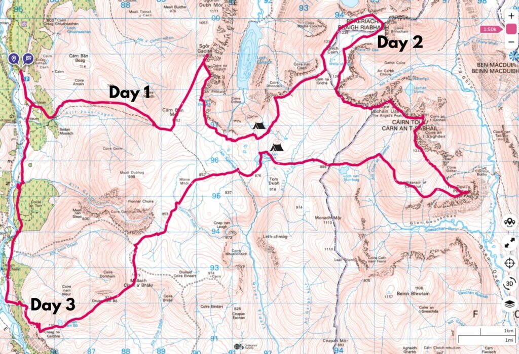
Here you’ll find my field notes from a three-day, 50km wild camping trip to some of the most remote hills in Scotland, including some of the highest in the UK. The Moine Mòr, or “Great Moss”, is a vast, high plateau in the Cairngorms between Glen Feshie and the Lairig Ghru. This route is also featured in Scottish Wild Country Backpacking, a Cicerone book I’ve come to really like as a resource for planning longer multi-day treks that are well off the beaten path.
FYI: This post contains affiliate links. If you make a purchase through one of my links, I might earn a small commission. Thanks for supporting the journey!
Trip Essentials: Moine Mòr from Glen Feshie
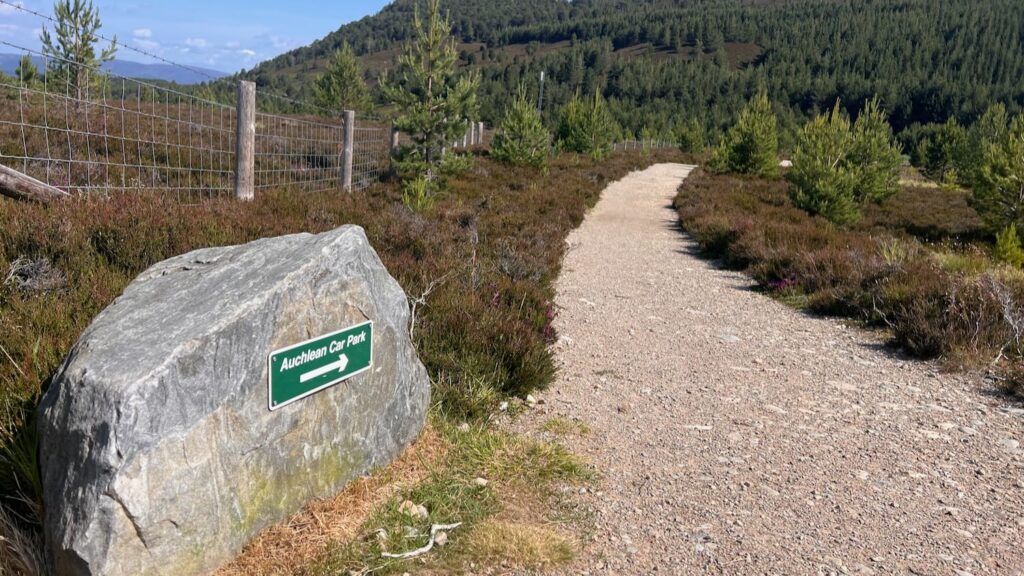
- Starting / Finish Point: Achlean Car Park (View on Google Maps)
- Total Distance: ~54 km
- Total Ascent: ~2400m
- Terrain: Combination of good tracks, no paths, heather, bogs, boulders.
- Maps: Cairn Gorm Ultramap
- Books: Scottish Wild Country Backpacking (Route 9)
- View GPX* on OS Maps
- View this route and more in our Interactive Route Map
Note: This GPX file is based on my own journey and intended for inspiration only. Much of the route involves off-piste terrain and may differ significantly from your own track. Always carry a map and compass and know how to use them.
Field Notes from the Moine Mhòr
Day 1: Sgòr Gaoith & the Windswept Plateau
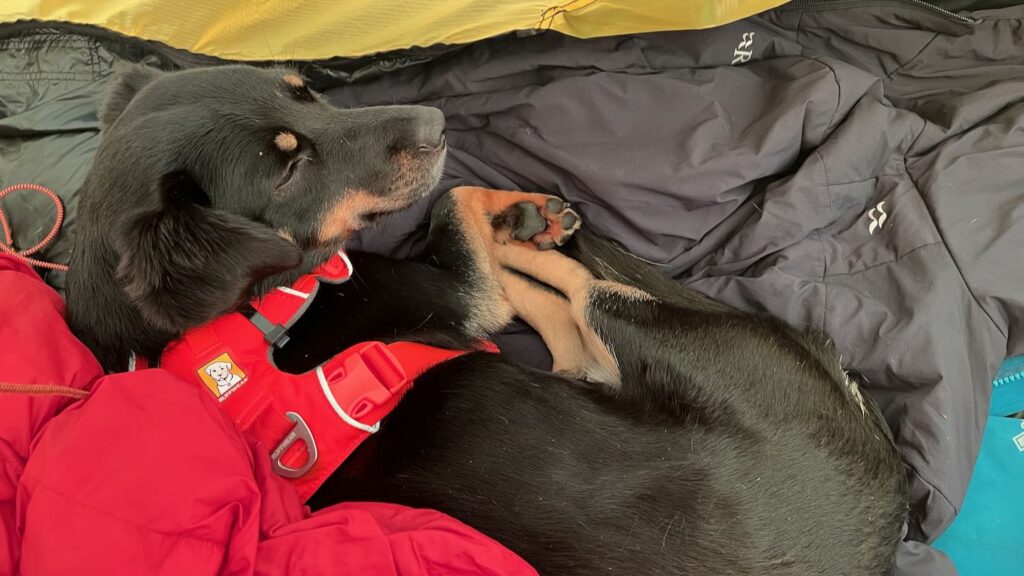
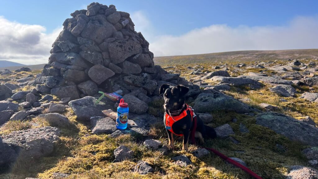
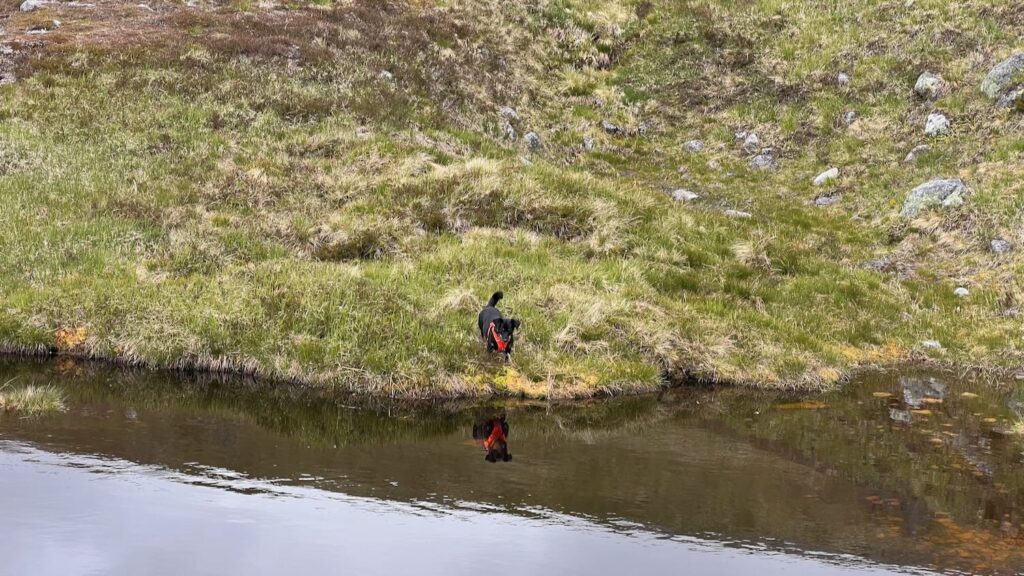
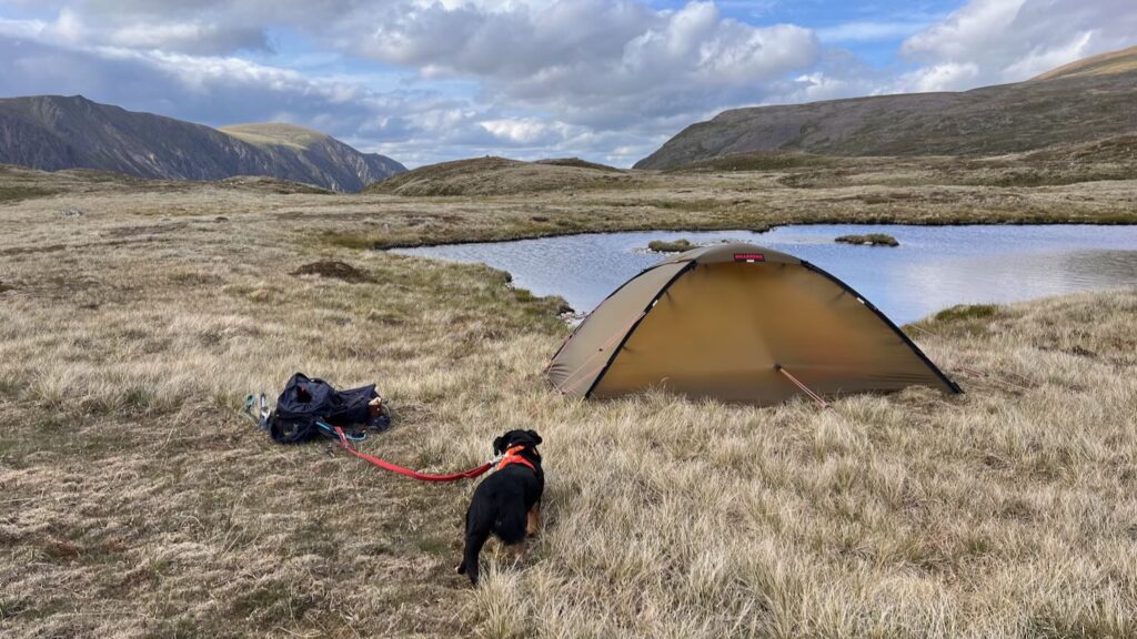
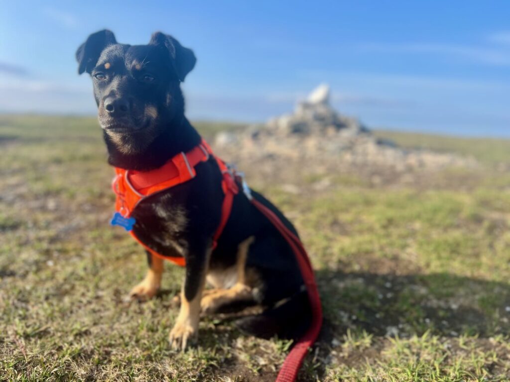
This trip was just Mila (our two-year-old rescue pup) and I for a change. Mila’s still getting to grips with the world (read: overstimulated by every moving object), so I new this would be interesting. It was also my first time taking the Hilleberg Unna out on a proper trip. Yes, it’s a 4-season tent and yes, it was June—but we all know that the Scottish mountains can experience all seasons in one day. With high camping planned and “feels like” temperatures near freezing, the Unna felt like a smart call.
I felt oddly anxious and disorganised this trip. Frazzled from van issues? Too much time off the hills? New boots (blister fest?)? Some intimidating distances and hills to climb?
What better way to face anxiety than to just get on with it…
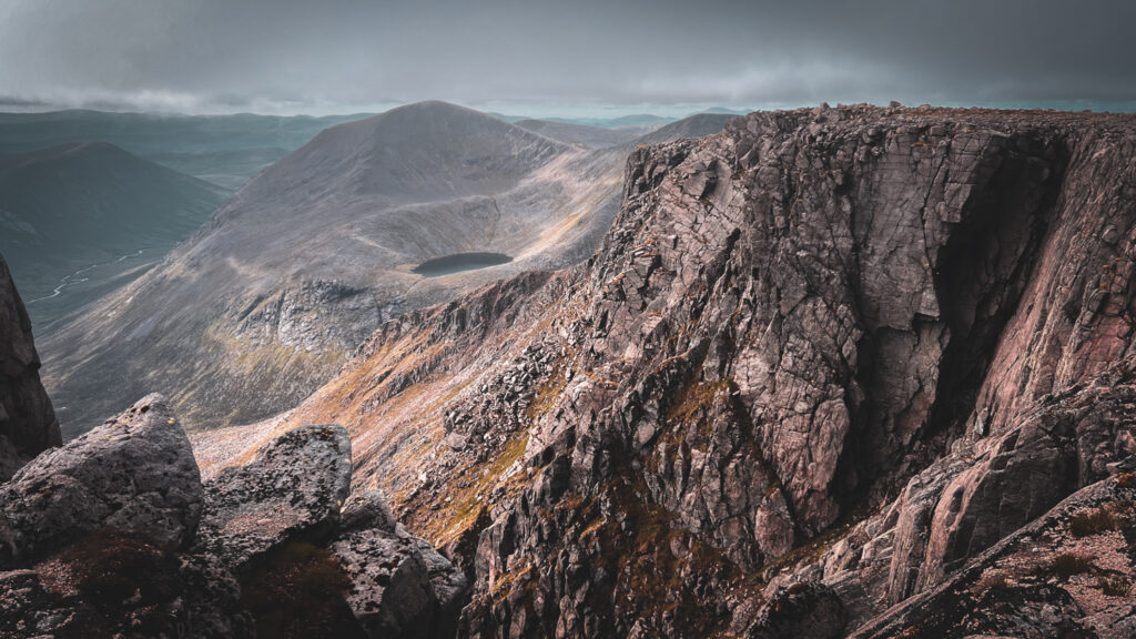
In the end I set off early from Achlean Car Park, a civilised noon start to see me to camp. Day 1 involves 11.5km and 820m of ascent, covering the two Munros Càrn Bàn Mòr (1052m) and Sgòr Gaoith (1118m) before descending to camp on the banks of Allt Loch nan Cnapan. Good tracks made the going quick and pleasant. I had the pleasure of meeting artist Carrie Fertig on my way up the hill. Mila was largely well behaved. My boots were OK, but I did stop to put some preventative Compeed on my heels (which ended up being a good idea).
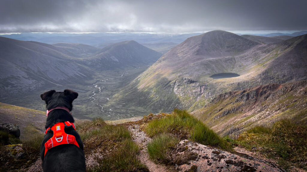
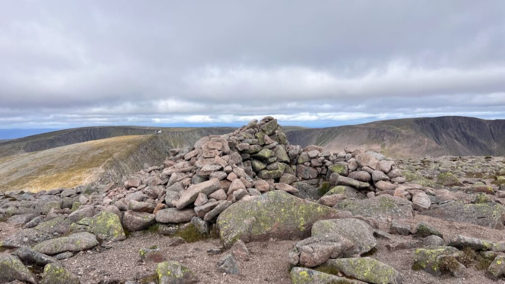
The views over Loch Eanaich from Sgòr Gaoith were dramatic and jaw-dropping, with a teasing glimpse of tomorrow’s Munros shrouded in mist across the corrie.
Things got rougher after descending towards camp. There’s a ruin of an old shelter on a tiny little loch, apparently called Ross’s Bothy after a deer stalker who used it in times gone by.
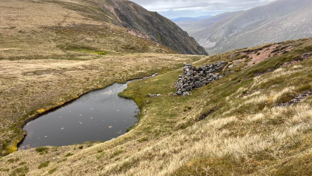
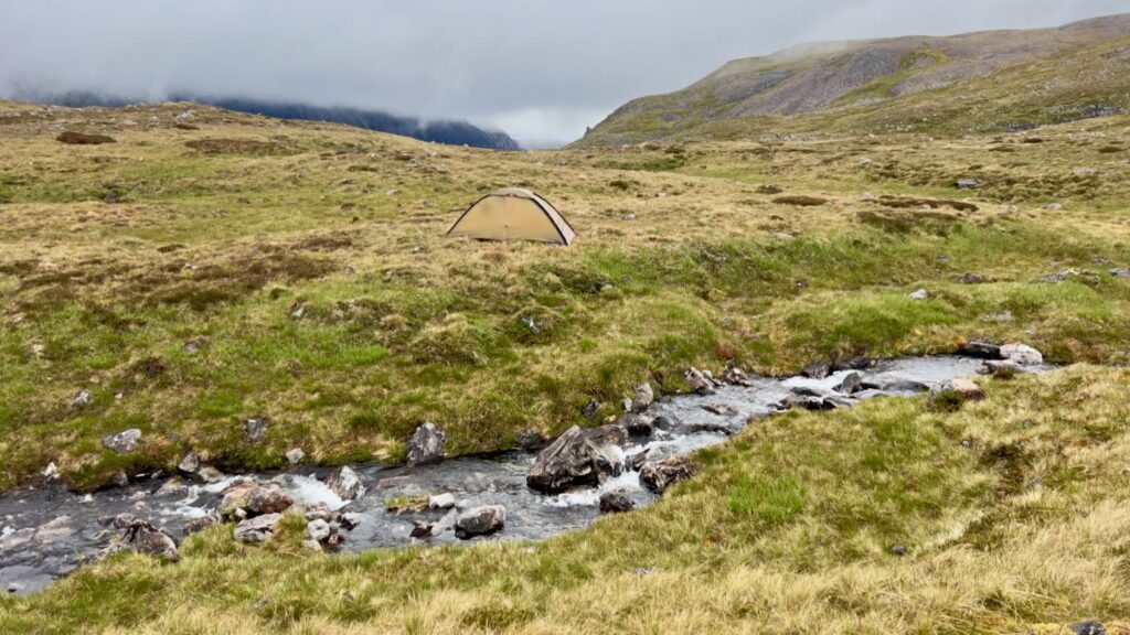
Further down, the path disappears and the ground becomes a rough slog through lumpy ground, glacial boulders and tiny lochans. I made it interesting by practicing some micro navigation along the way, taking me to Allt Loch nan Cancan. There’s plenty of good ground around here for a tent, but it was just 4pm at this point, and I thought I might as well go a bit further and get a head start on tomorrow.
I should have stopped! Rain rolled in. Heavier. Mila and I were soaked by the time the tent was up. Note to self (again): pack a towel. I dried Mila with a spare sock. Dinner helped restore Mila’s morale: a pre-prepped rice, chicken, and cheese dehydrated number just for pooches.
So my first night in the Unna was a chance to test out some of its interesting features. I went off piste here with my usual tent move (bright colours and huge vestibules, e.g. Big Agnes Copper Hotel). With the Unna I went for the subtle “sand” coloured edition. And it has a minuscule porch. But there were perks…
First off, it was super easy to set up with just two identical polls to deal with. Secondly, it’s huge, could easily sleep two. And there’s a hack – you can unclip one corner of the inner tent and fold the tent back to make a porch as huge as you need. This is very useful if you have a load of wet gear that you want to avoid bringing in the tent. I’m also digging a tent that has a colour which blends into the landscape.
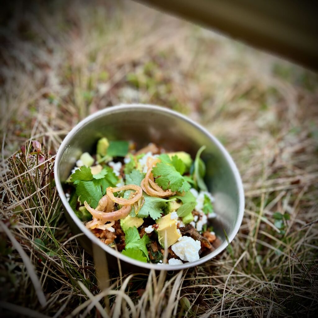
The weather improved and the wind eased as the evening wore on. I had no phone signal (bliss) so there was nothing to distract me from being in the moment. There was, of course, the camp feast – a real garnish fest. It started with one of my dehydrated backpacking meals, Mexican red rice & black beans: decanted into my MSR Titan Kettle (a great bit of kit for its capacity, light-weight ness, and ability to stow a V60 coffee dripper). Pour over some water. Bring to a boil. Then cover and let hang out while I prepped the garnishes… sliced avocado, crumbled feta, fresh coriander and oregano, sliced jalapeño, pickled shallots, and the wild card – dehydrated kimchi (which consequently would have works great as a lime substitute). Paired with fresh lemon and ginger tea.
Another bit of kit that came into its own is my new Garmin inReach + messenger app which enabled me to stay in touch with the homestead. The subscription is a bit hefty (£14.99 per month) but you can’t put a price on personal safety and the peace of mind for friends and family.
An early night before an early start the next day.
Day 2: Braeriach, Cairn Toul, and the Devil’s Point
A LONG DAY. And I couldn’t even measure it accurately because my watch ran out of charge in the middle of it!
Here’s where guidebooks can be misleading. Scottish Wild Country Backpacking suggests this 32 km day with 1380m of ascent should take 8–10 hours. But by Naismith’s Rule (15 minutes per km + 10 minutes per 100m ascent), that’s at least10 hours on flat terrain—never mind the boulder fields and off-piste sections.
So I started early—6am—and aimed to get as far as I could.
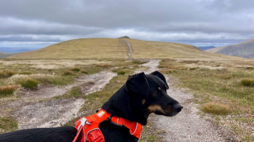
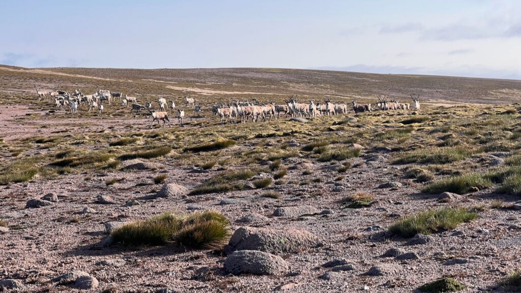
After navigating the undulating glacial ground, the going gets significantly easier with easy ground underfoot. The climb north follows the edge of the Coire Dhònnail with spectacular views of the prior day’s summits. Atop the plateau, a string of cairns led to the summit of Braeriach (1296m), the UK’s third-highest mountain.
The most terrifying part of this section was the massive herd of stags – one of the few moments I appreciated Mila’s shrill bark!
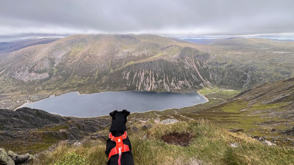
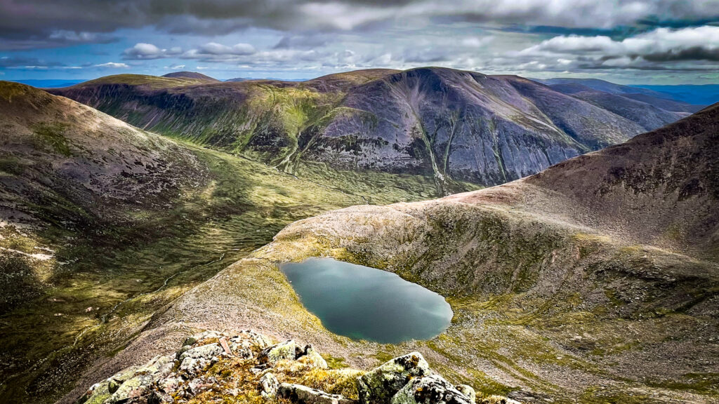
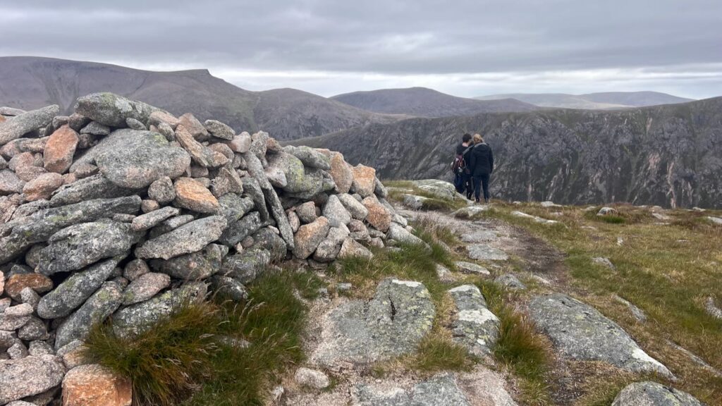
The views from Baeriach are incredible. The scene is dominated by the Lairig Guru below, with Ben Macdui opposite (the UK’s second highest mountain), and the impressive Lochan Uaine (the green lochan) in the distance.

The ongoing amble across the next three Munros was a delight with constant views and very few people.
Sgòr an Lochain Uaine (1258m)
Cairn Toul (1291m)
The Devil’s Point (1004m)
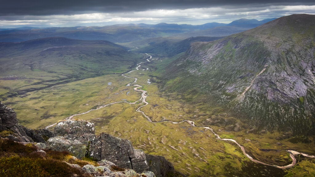
Of course all good things must come to an end, and that included the straightforward hillwalking on often good paths. After Devil’s Point, we headed off piste to contour around the hillside and make our way towards Loch nan Sturleag which felt like an eternity. Thankfully there were views of Glen Dee, pretty waterfalls, lochans, and lichens to enjoy along the way.
In what felt like big time back country conditions, I was surprised to spot two people lounging by the loch. The spot would have made a nice place to camp, but I decided to carry on towards Loch nan Cnapan.
At this point it was near 5pm – I’d been out 11hrs and was still one Munro and a big descent away from the Glen Feshie, the intended stop for Day 2. But I decided to pack it in as the Loch was idyllic, the weather was nice, and though very tired, I still had energy to enjoy the camp which is half the joy for me of these escapades.
Dinner was a special kind of awesome – I had with me a dehydrated mushroom pilau. To this I added some fresh chard from home, then garnished with everything I could get my hands on: chilli pickle, feta, chaat masala, fresh coriander, mango chutney – possibly the most rewarding meal I’ve ever eaten!


Day 3: Mullach Clach a’ Bhlàir and Homeward Bound
The journey home. Another early start, this time at 5am. My bag was noticeably lighter having eaten almost all of my food. This made the going easy as I left the Loch and carried on west towards the Allt Sgairnich where a good track emerges. The track is a bit industrial, but I was grateful for it after all the off piste trudging of the last stretch. The track leads to the final Munro of the journey – Mullach Clach a’ Bhlàir (1019m). A gentle summit more reminiscent of Dartmoor than the Cairngorms, marking a mellow finish to the high drama of yesterday.
It’s downhill from here! Which if you’ve hiked in Scotland enough know that this is never easy. The track carries on down Druim nam Bò, then descends further to meat a huge cairn at Craig na Gaibhre. Here the fun lies in finding an old stalker’s path that zigzags downhill. I managed to find and follow this track for a fair while, but then I managed to lose it closer to the treeline. I could see below the track in Glen Feshie, so decided to screw the path and trudge downhill through through the deep heather. This was a special kind of hell. At least it was soft and there were some lovely trees.
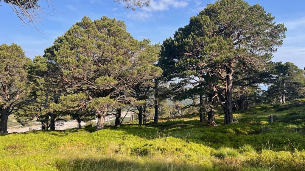
Note: These trees are much a result of better land management. In the early 2000s, a new landowner brought deer grazing under control which saw the old pine trees self-seeding and ultimately widespread regeneration. This is what Scotland should be like! There’s no denying Glen Feshie is a beautiful place.
I will never doubt the loyalty of Mila after she followed me down that hill! It was a relief to find the track, which meant a now “easy” two-ish hour walk back to the van.
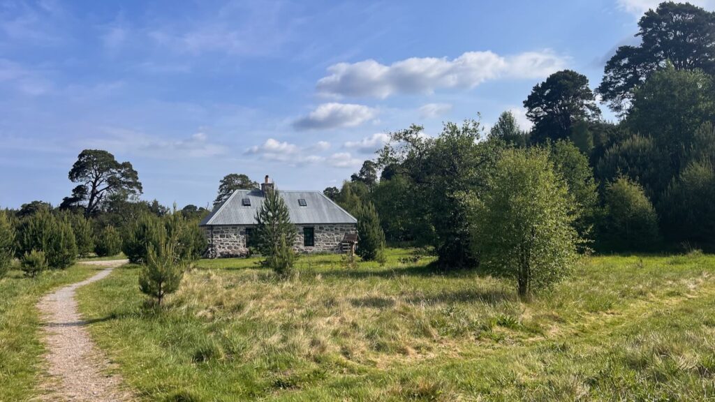
The track intersects the exquisite Ruigh Aiteachain bothy, which is really too nice to be called a bothy – it even has a toilet. Mark and I stayed there a couple years ago. This was the recommended stop for Day 2 according to the guidebook, but that would have been too long a day for me (it took me an additional 4 hours to get to this point from my camp on Loch nan Cnapan!).
The final walk was hot and stony, but a low-flying red kite lifted my spirits. And then—sweet joy—a sign for the car park.
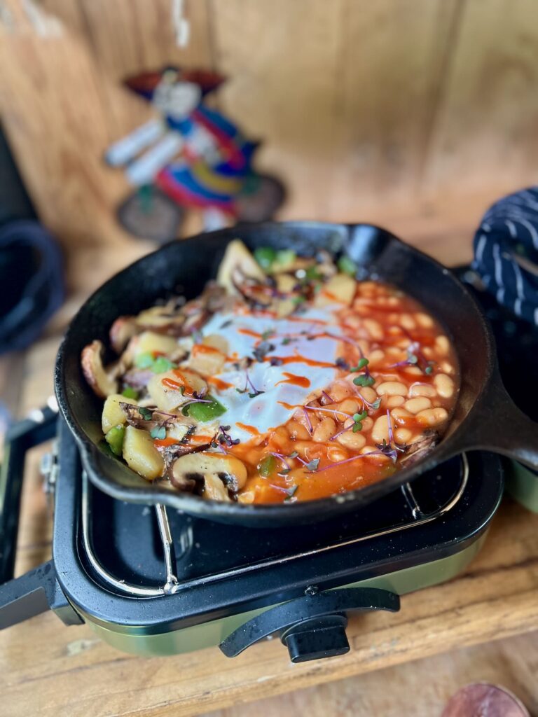
I was back at the van by 11am for a second breakfast. This is when I was glad I’d kept some tinned potatoes and baked beans stashed for those “just when you need it” moments. This was one of those moments! I sautéed some peppers and mushrooms with the potatoes, then added the baked beans and topped with an egg. Covered with a plate until the egg was cooked through. Served with Sriracha. I call it a Full English shakshuka (you could add sausages / bacon etc to make it the real deal!).
Gallery
Day 1


Day 2


Day 3


 Gleann Leireag Walk from Tumore
Leave a Reply