

Most Quinag walks follow the same well-trodden circuit from the A894 car park — up Spidean Coinich, along the ridge to Sail Gharbh and Sail Ghorm, and back the way you came. It’s a brilliant day out and rightly popular. But Quinag has more to give than the standard loop, and this post describes an alternative: a point-to-point Quinag traverse that takes in two of the Corbett summits (and you could easily add on the third) before descending the steep and rarely visited eastern face of Sail Ghorm to finish at the B869. It’s committing, off-piste terrain that requires sound navigation skills and good conditions — but it’s one of the more rewarding ways to explore this part of the North West Highlands Geopark, and opens up a corner of Assynt that most walkers never reach.
Download file for GPSNote: This GPX file is based on my own journey and intended for inspiration only. Much of the route involves off-piste terrain and will no doubt differ significantly from your own track. Always carry a map and compass and know how to use them (or sign up for a navigation course to skill up for better safer adventures!)!
Also FYI: This post contains affiliate links. If you make a purchase through one of my links, I might earn a small commission. Thanks for supporting the journey!
Trip Essentials
- Start: Quinag car park, A894 (NC 2310 2745)
- Finish: B869, near Loch Airigh na Beinne (NC 1745 2650) — you’ll need a second vehicle or someone willing to collect you
- Total Distance: ~10.5km
- Total Ascent: ~1040m
- Terrain: Good path to start, then off-piste and committing on the eastern descent from Sail Ghorm. Numerous lumps and bumps on the lower ground. Boggy in places. Not suitable in wet or icy conditions.
- Maps: Assynt & Coigach Harvey Map
- View on OS Maps
- View this route and more in our Interactive Route Map
Field Notes
This route came about almost by accident, which is often how the best ones do.
I was guiding a navigation day for a guest staying at the byre — the first artist to use our new creative retreat space. The original plan was a skills-focused walk in the local area. Then, the evening before, I got this message:
“I wondered if it might be possible to change up the plans to take in more the area of Quinag and the geopark. I was taken in by the scenery as I was driving through.”
She also mentioned being specifically drawn to what she called “the long edge.” She’d spotted something real about Quinag’s character from the view behind the byre. Of course I said yes!

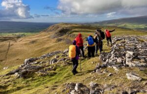
We started from the main Quinag car park on the A894 on a genuinely exceptional day — clear skies, great visibility, no wind to speak of (initially). Lucky came along too and contributed his own interpretation of route finding throughout, while conducting thorough social research with every other dog on the hill.
Spidean Coinich and on to Sail Ghorm

We began with the basics: setting the map, orientating to the ground, spending time reading the contours before moving. For anyone new to navigation, Quinag is a superb classroom — its distinct ridges, faces and summits are legible on the map in a way that makes the connection between paper and ground very immediate.

From the car park, the path up to Spidean Coinich is well-trodden and straightforward. We used the ascent to work through distance, direction and duration — the three D’s that underpin practical navigation — weaving in some timing and pacing where the ground allowed. In good visibility you can cross-check your predictions against what you’re seeing in real time, which builds confidence faster than almost anything else.
From Spidean Coinich the ridge continues northwest. The views open up considerably here — on a day like this, you’re looking across to Suilven, Canisp, and the whole Assynt geopark spread out to the south and west. It’s hard to move quickly because you keep stopping to look.

The summit of Sail Ghorm is the most northerly of Quinag’s three main tops and, on this day, noticeably windier than anywhere else on the ridge. It’s a good spot to pause and look east — which is exactly what we did.

The decision
I’d always been curious about Quinag’s eastern face from this point. I’d studied it from the road and from other hills but never descended it. On a whim, I mentioned this out loud. Without much hesitation, she suggested we give it a try rather than go back the way we came.

This is actually the point of a good navigation day. By this stage we’d been studying that eastern slope for hours — from the road the night before, from the ridge as we approached, from the summit. We had a reasonable picture of what the contours were telling us: steep upper section, easing lower down, with some complex lumpy ground before the valley floor. Dry conditions. Daylight to spare. We committed to it.
The descent
The upper section is steep and requires care — this is not a path, and there’s no margin for rushing it. Slow and steady, picking a line, checking the map regularly. The ground does ease as the contours suggest, dropping towards Loch Airigh na Beinne. One small practical note: the fence shown on the OS map in this area doesn’t exist, which made life easier.

The lower ground is a mix of bog, heather and the kind of knobbly terrain that tests tired legs. We followed the line of the Allt Gleannan nan Caorach downstream, which is a reasonable guide through this section. Along the way we passed through a small patch of woodland — genuinely magical in the afternoon light, and the kind of spot where you immediately start mentally placing a tent.
We eventually reached the B869, where Mark came to collect us and drive us back to the car. At that point in the day, this felt like an extraordinary service.
A note on this descent
To be direct: the eastern face of Sail Ghorm is not for the faint-hearted, and it’s not a route to attempt in poor visibility, wet rock, or without solid navigation skills. But if the conditions are right and you have the experience, it’s a genuinely rewarding way off the hill — you come out into an empty, rarely visited part of Assynt that most people never see.

That sense of shaping your own route and committing to ground you haven’t walked before is, I’d argue, what hill days are actually for.
Further reading
If you’re building up to something like this, it helps to have a few navigation days under your belt first. We run hill skills and navigation sessions in exactly this kind of terrain — the focus is on practical skills and shared decision-making, not just following a guide up a hill.
For more Quinag routes, see our Quinag from Tumore post for an alternative approach from the west, and the North Assynt Traverse if you’re thinking bigger. For remote off-piste navigation in a different setting, the Ben Alder wild camping route is a good reference point for what committing to complex ground over multiple days looks like.


 Veggie Lentil moussaka: Easy TrayBake + Dehydrator instructions
Leave a Reply