The Fannichs are a group of remote mountains in the northwest of Scotland near Ullapool. There are nine Munros in the Fannichs, and many require a rather long (and boggy) walk in. But as this day proved, it’s totally worth it. It helped I had spectacular weather: cloud inversions, a calm breeze, balmy weather for autumn, and the place largely to myself. The stuff that mountain dreams are made of! This walk takes in three of the nine Fannichs Munros: Meall a’ Chrasgaidh, Sgùrr nan Clach Geala, and Sgùrr nan Each.
Trip Essentials – Fannichs Munros
These are my personal notes and are here to give you some inspiration for your own journey – they shouldn’t be used as a guide! If you’re heading to the hills, make sure you or someone with you has solid map reading and navigation skills. You’ll find links below to relevant maps and resources to help you plan your own adventure. Have fun and stay safe out there!
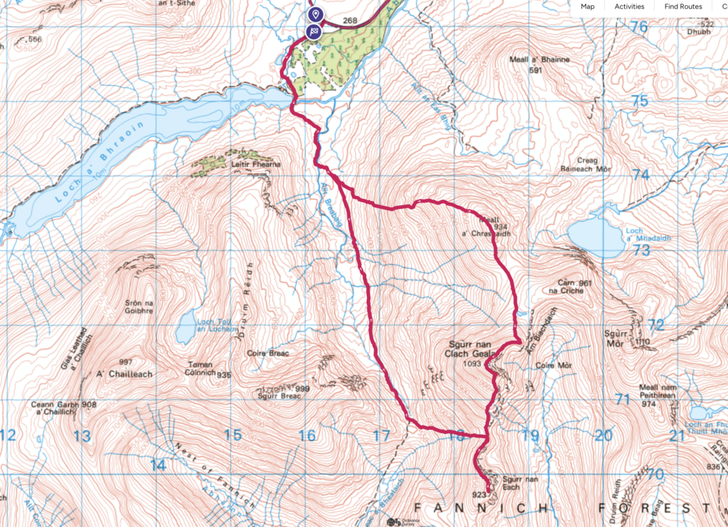
- Starting / Finish Point: Layby off the A832 (View in Google Maps)
- Total Distance: ~19km
- Total Ascent: ~1160m
- Terrain: A good track to start, then a steep off piste boggy slog before meeting the superb ridge which makes it worth it. Long boggy walk to finish down a pathless steep hill, then rough track.
- Maps: OS Explorer Map 445 / Foinaven and Ben Hope Harvey Map
- View GPX on OS Maps
- View this route and more in our Interactive Route Map
FYI: This post contains affiliate links. If you make a purchase through one of my links, I might earn a small commission. Thanks for supporting the journey!
Gaellic Translations
Meall a’ Chrasgaidh – “Hill of the Crossing” or “Hill of the Pass.” Meall means “hill” or “mound,” and Crasgaidhrefers to a crossing or pass, possibly indicating its location near a natural pathway.
Sgùrr nan Clach Geala – “Peak of the White Stones.” Sgùrr means “peak,” Clach means “stones,” and Geala is the plural form of geal, meaning “white.” This likely refers to pale rocks or stones on or around the summit.
Sgùrr nan Each – “Peak of the Horses.” Sgùrr again means “peak,” and Each (pronounced like “yach”) means “horse.” This could refer to the area’s shape or to local associations with horses.
Field Notes – Fannichs Munros
After a summer beneath the clouds, at last we had a break in the weather. I had my other work to do, but I decided to put it aside and take Lucky to the Fannichs near Ullapool. This area was new to me and has been long on my list. I couldn’t have asked for a better day.
An early start at 5:45am got me there just after 7am where I had a quick breakfast (yoghurt, orange, and Lizi’s Low Sugar granola which turned out to be enough energy to fuel me for all three hills!). Another group arrived loaded up with camera equipment who I spotted later set up on Loch a Bhraoin, assuming to catch some sunrise reflections. Wise – it was the perfect morning for it!

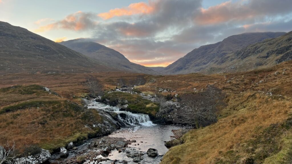
The hike starts simply enough along the track off the A832 then up a pleasant river valley. Look out for a small pile of stones that indicates a Ford where you can cross the river (with care!) and meet the rough ATV track on the other side. I followed the track uphill until it started veering further along up the river – the goal of course was Meall a’ Chrasgaidh, the first hill of the day. This meant leaving the track and heading up steep ground for about a kilometre. Though steep, the ground underfoot was fairly pleasant and I had the sunrise to watch along the way. It levels out considerably closer to the summit, which is when the glory of the day really began.
Meall a’Chrasgaidh

At the top of the first Munro of the day I met a nice couple from Skye. I felt weirdly socially awkward, and realised I was out of practice with talking to other hillwalkers (we’re still slowly acclimatising our rescue pup Mila to strangers which means I tend to avoid interacting with other people lest they find her tendency to bark a disturbance to the peace!). On this day, it was just me and charming Lucky, so we were able to enjoy some bander before I carried on to the best of the day’s drama.
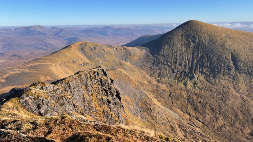
Sgùrr nan Clach Geala
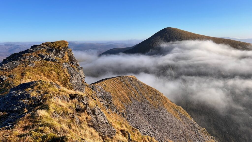
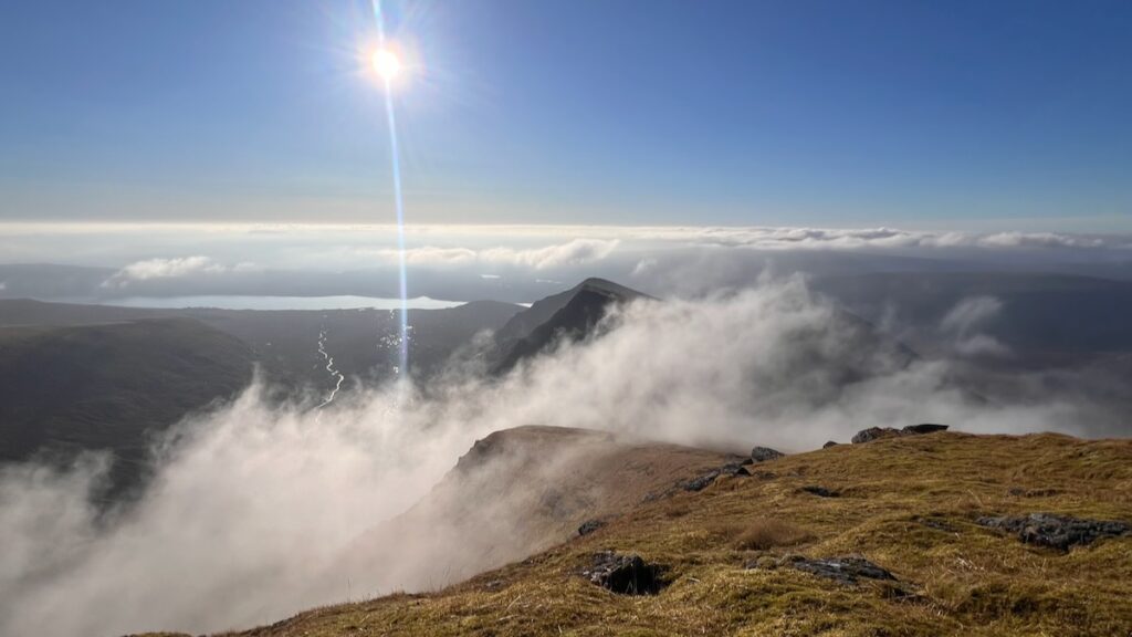
Quoting walkhighlands: “Sgùrr nan Clach Geala is the finest of the Fannichs, with its impressive eastern corrie.” In truth, I haven’t yet visited the other six Munros in the Fannichs, but this one was pretty special. High drama as I climbed the ridge to the summit (there is a very well trodden path). Clouds came and went as I carried on adding to the drama. Near the top I stopped to take the photo at the top of this post – excited to catch an inversion, and a Brocken Spectre!
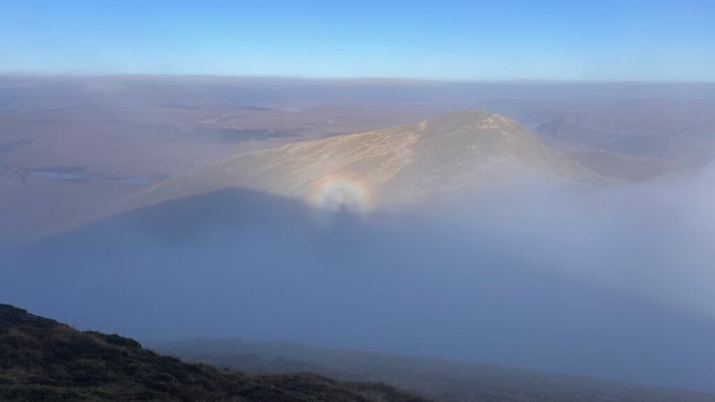
By the time I got to the summit itself, the inversion had totally dissipated!
But there were still plenty of ever-changing clouds around which provided endless fascination.

Onwards to the last summit of the day…
Sgùrr nan Each
The onward journey is equally delightful, more ridge walking, and lunch on the summit to enjoy the views. Lucky took a nap while I dined hugely on black beans and crown prince squash!

The journey back
Is long! I bumped into the Skye couple on my way down from Sgurr Nan Each (feeling more socially capable this time!) – we’d both taken a break from our computers to enjoy this marvellous day and we mutually appreciated how lucky we are to have this on our doorsteps (well, in Scotland, a 1.5hr drive might as well be on your doorstep).

The descent is extremely steep for a while, eventually meeting a rough track that reunites with the rough ATV track back to the start. It’s 7km of rough, wet walking so come prepared with something to think about to pass the time! Though hopefully you will have a fantastic day out with plenty to reflect on. Deep thoughts about life and science, such as – when’s my next chance to get above the clouds? (Which incidentally inspired this post: how do cloud inversions form?)
Gallery – Western Fannichs


 What is a Cloud Inversion? (And How Do they Work?)
Hi Monica. I’m Martin from germany and i’m exploring scotland by mountainbike since 2012. I have just found your very interesting website and noticed that you already visited places, i also want to ride in the future. I have planned one trip where you might be able to help me, whether that is feasible, especially at two spots. You can view it here: https://highlandsmtb.de/uebersicht/ The tour is “Outstanding: What’s left”.
First point, i want to cross Loch Fannich at the western end, then up the valley and down at the other side to Loch a’Bhraoin. You wrote that the downhill is ” rough, wet walking”. Do you think hike-a-bike is doable on this route? I’m pretty used to pushing and carrying a lot in the highlands as long as there are no fundamental obstacles. And another spot is Gleann Leireag but this is not that bad i persume? There are some other pushing parts, i.e. along Loch Dionard or between Loch More and Loch Glendhu or near Loch Monar. Well, I guess I’ll just have to grin and bear these. Cheers, Martin
Hi Martin. I don’t ride mountain bikes so my advice may be of limited use! Gleann Leireag is not that bad, at least on foot. My memory is hazy on that section of Loch Fannich you mention, but I suspect it’s doable, albeit a grin and bear it situation!