Field notes from a tough but rewarding three-day long distance walk across north Assynt, taking on the Foinaven ridge and some of the lesser visited hills in this very remote part of Scotland. There are options to tack on more hills like Glas Bheinn, or Ben More Assynt, but I was deterred by midges and a dwindling supply of food. There are no shops or restaurants on this route, so be prepared to carry food to last the journey (or enlist a friend to meet at one of the road sections for a re-supply!). This was in part inspired by Sutherland Trail by Cameron McNeish, which doesn’t cover this route exactly, but has loads of inspiration for crafting a journey around northwest Scotland.
Trip Essentials: north Assynt Traverse
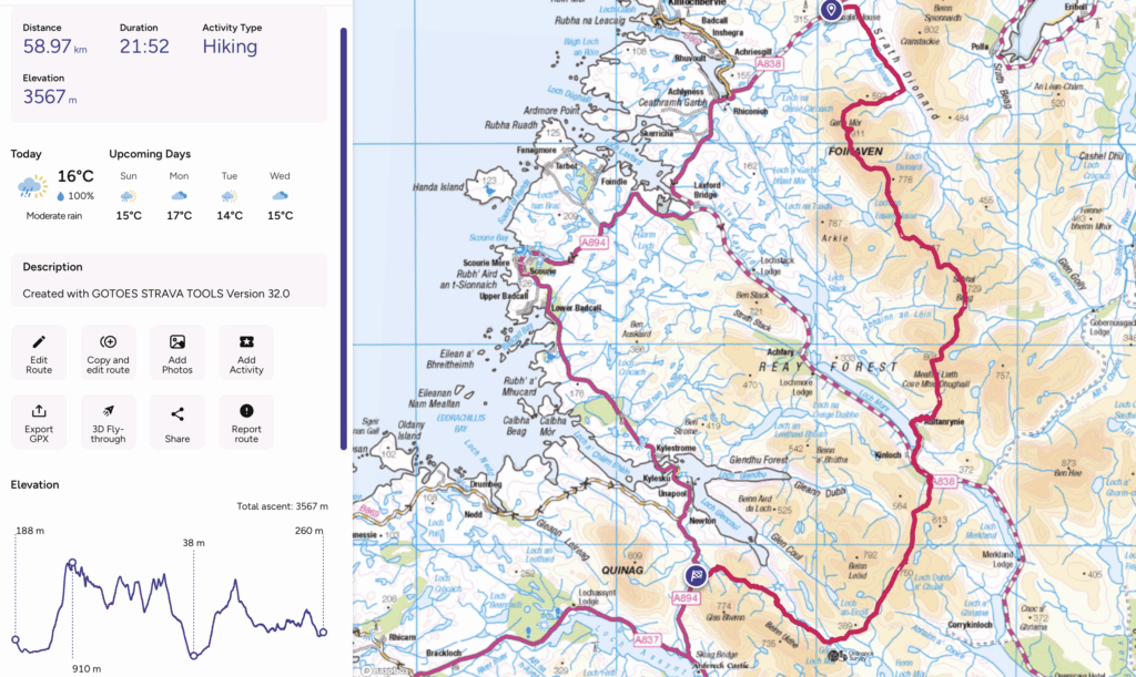
- Starting / Finish Point: Gualin Ho (NC 3067 5662) / A894 (NC 2397 2840)
- Total Distance: ~60 km
- Total Ascent: ~3500m
- Terrain: A good track to start then mostly off piste, plenty of good ground but also the requisite bogs and boulder fields of the area.
- Maps: OS 442 and OS 445
- View GPX* on OS Maps
- View this route and more in our Interactive Route Map
Note: This GPX file is based on my own journey and intended for inspiration only. Much of the route involves off-piste terrain and will no doubt differ significantly from your own track. Always carry a map and compass and know how to use them!
FYI: This post contains affiliate links. If you make a purchase through one of my links, I might earn a small commission. Thanks for supporting the journey!
Field Notes from a North Assynt Traverse
Day 1: Foinaven Traverse – ~16km
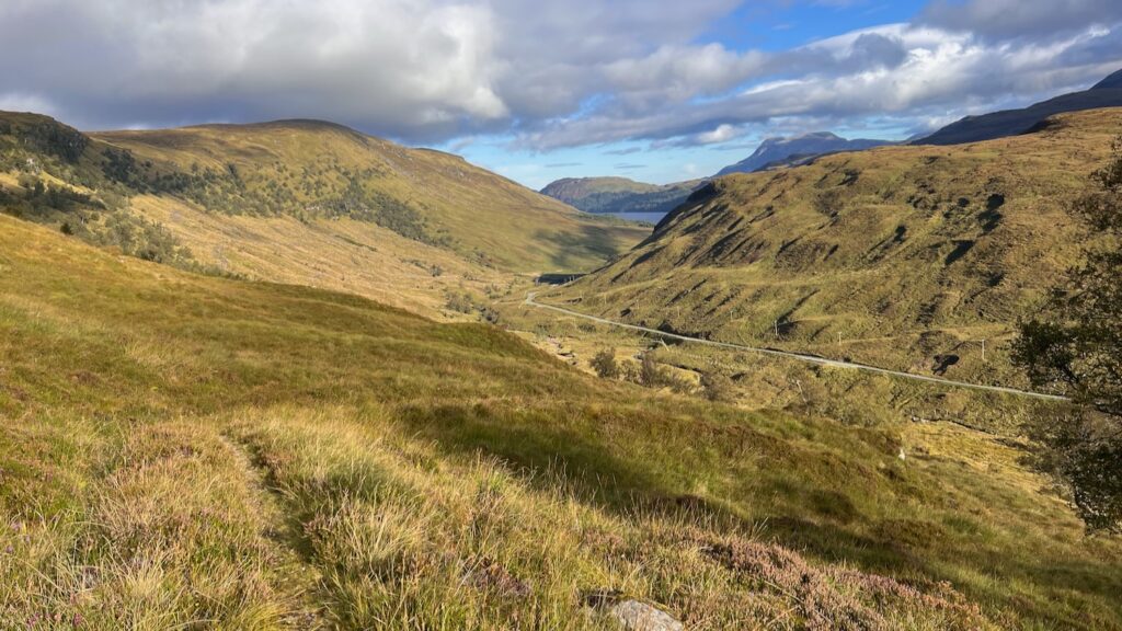
I had a lot of nerves going into this day—fear of the unknown, maybe? Foinaven had been on my bucket list for a while, so I should have been excited to finally be tackling the full ridge. But instead, I felt anxious as I set off up the easy track through Strath Dionard. I’d read that this is a challenging, long, and steep route, and the photos of the ridge looked foreboding, but inviting. How manageable would it be with my heavy pack? I was about to find out.
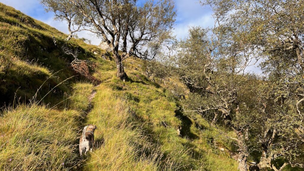
Roughly 6.5km into Strath Dionard, it’s time to leave the comfort of the track and head uphill. This route offers perhaps the “gentlest” ascent to the ridge, starting with a climb to Bealach nan Carn between Cnoc a’ Mhadaidh and Ceann Garbh. As I began the ascent, my nerves began to settle. I realised that yes, I could still hike up a steep hill while carrying an absurdly heavy load.
(How heavy? I estimate around 18kg—I was carrying food for four nights and luxuries like an DSLR camera!)
I stopped midway up for lunch: a solid lunchbox of leftover salads—puy lentils, tabbouleh, cardamom rice, feta—from the night before. Worth every gram, both to ease the load and fuel the rest of the climb.
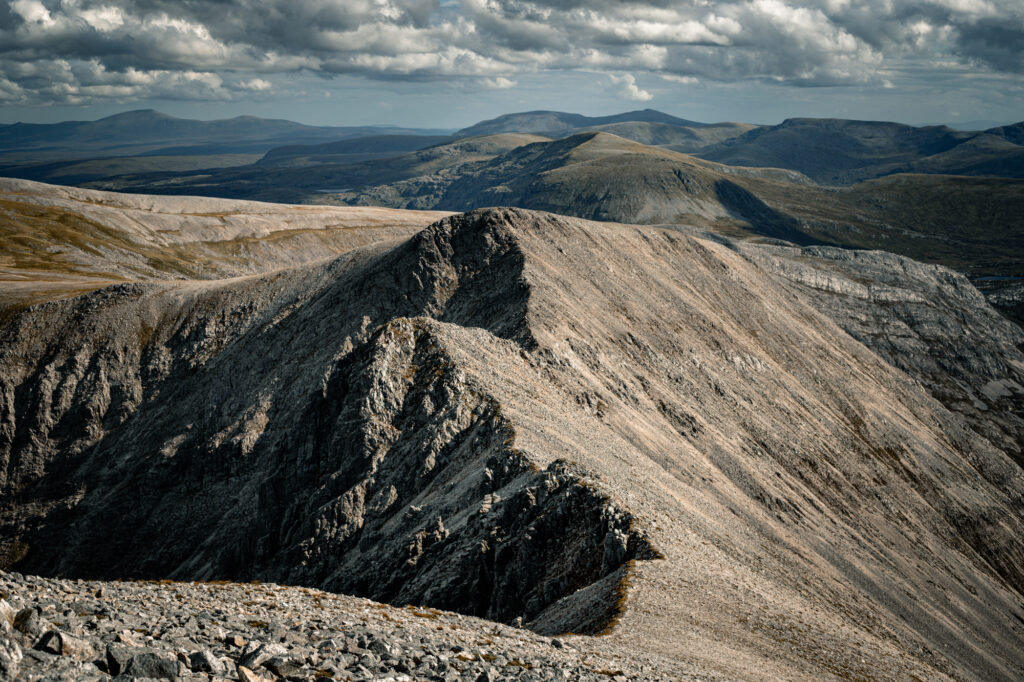
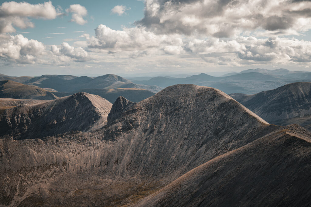
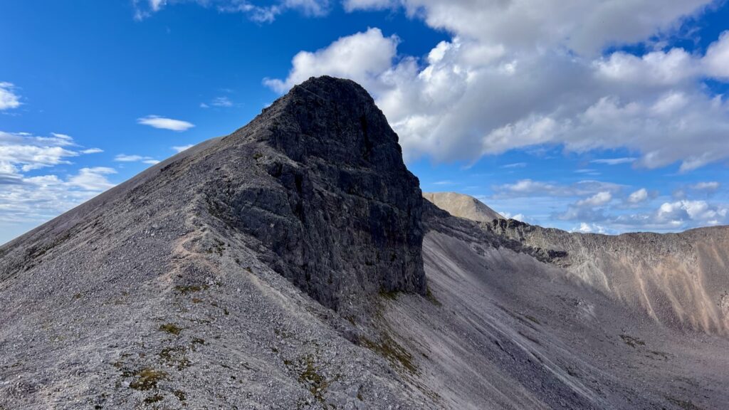
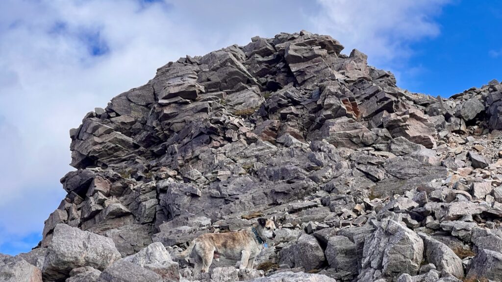
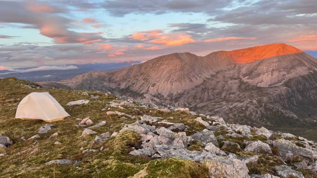
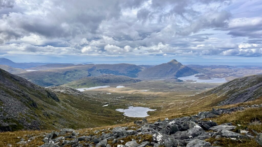
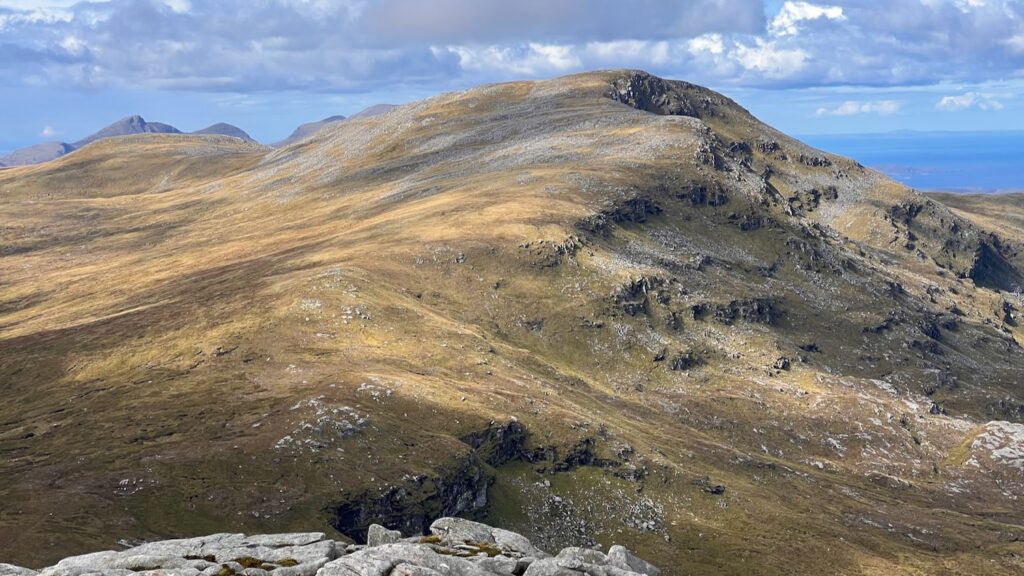
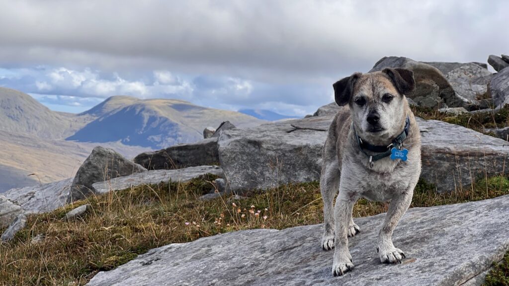
By the time I reached Ceann Garbh (902m), my nerves had mostly settled. From here, the glorious Foinaven ridge stretched out before me. There was a clear path along the first section, though I did wonder how on earth I’d manage to overcome what I dubbed “the notch” (see photo below). Still, I was feeling confident and carried on with gusto. The views were astounding—Foinaven must surely be one of the finest ridges in the UK. And I had luck on my side: perfect weather and endless visibility.
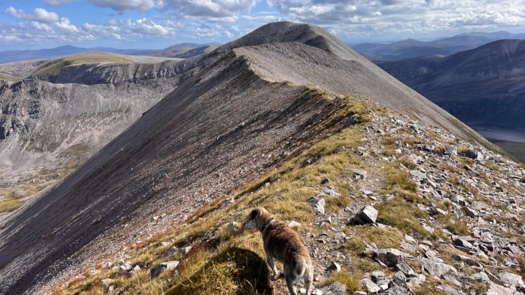
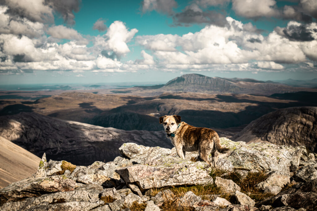
As it turned out, the entire ridge was totally doable, for both Lucky and me the mule. The notch, intimidating from one side, proved much more approachable when seen from the other. Well, about as approachable as a boulder field gets.
While negotiating one of said boulder fields, I encountered the only person I’d see the whole trip—a friendly guy on his own mini-adventure, deciding whether to descend and hitchhike back to his car (he did—I assume successfully!).
Foinaven’s Geology
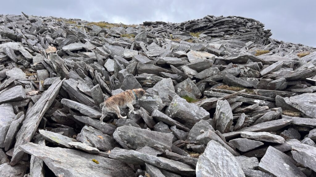
Foinaven’s dramatic form owes much to its geology. It’s composed primarily of Cambrian quartzite, a tough, pale rock that weathers into massive scree slopes and craggy ridges. This quartzite lies atop a foundation of much older Lewisian gneiss, some of the oldest rock on Earth. Over millennia, glaciation and erosion have sculpted Foinaven’s long, serrated ridge and its huge corries, giving it an appearance that feels almost Alpine in scale. The fractured, blocky nature of the quartzite is what creates those vast boulder fields and steep, broken slopes—both beautiful and brutal underfoot.
Toward the end of the ridge, a bit of light scrambling brought us up Cadha na Beucaich and onto the 808m contour.
Leaving the boulders of the Foinaven ridge behind, it was something of a relief to be back on grassy terrain. Even Lucky had a new bounce in his step as we continued toward our still-to-be-determined camp.
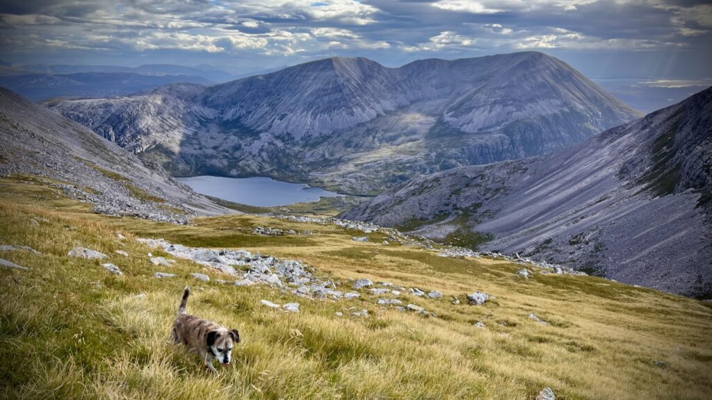
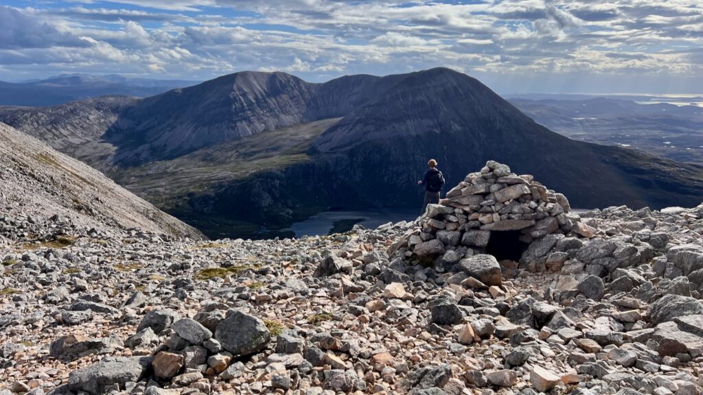
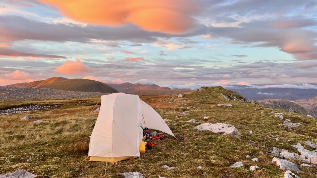
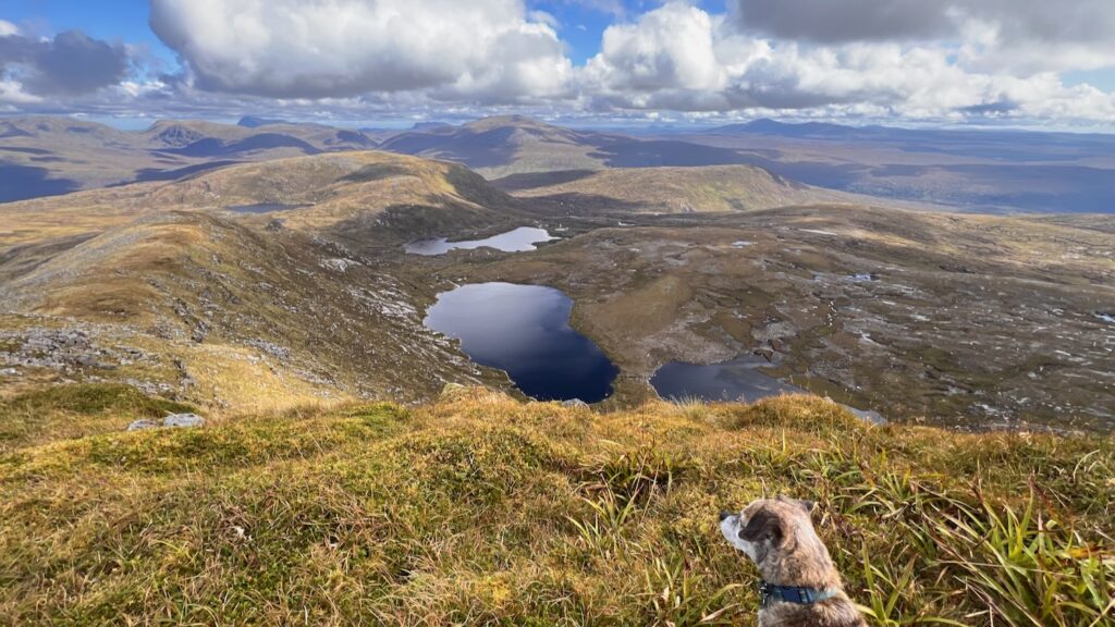
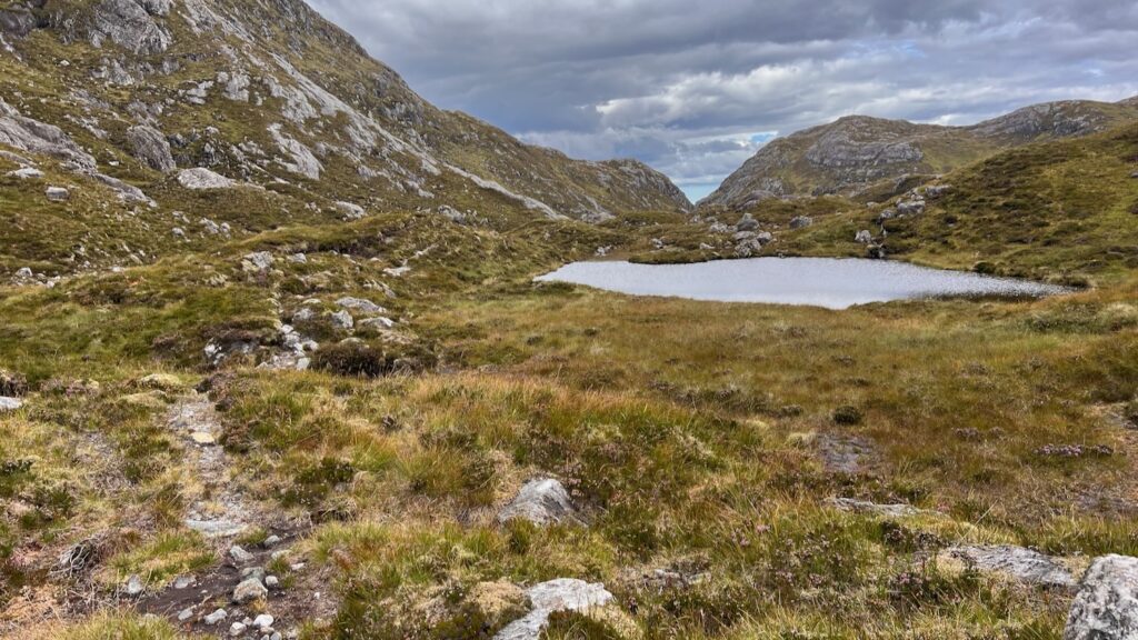
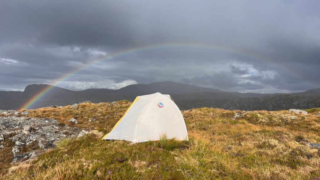
My original plan was to descend to Bealach Horn, but I’d spotted a little lochan on the map that looked tempting—and it turned out to be one of the most beautiful places I’ve ever had the pleasure to camp. From there, we had a stunning view of Arkle, an equally impressive ridgeline.
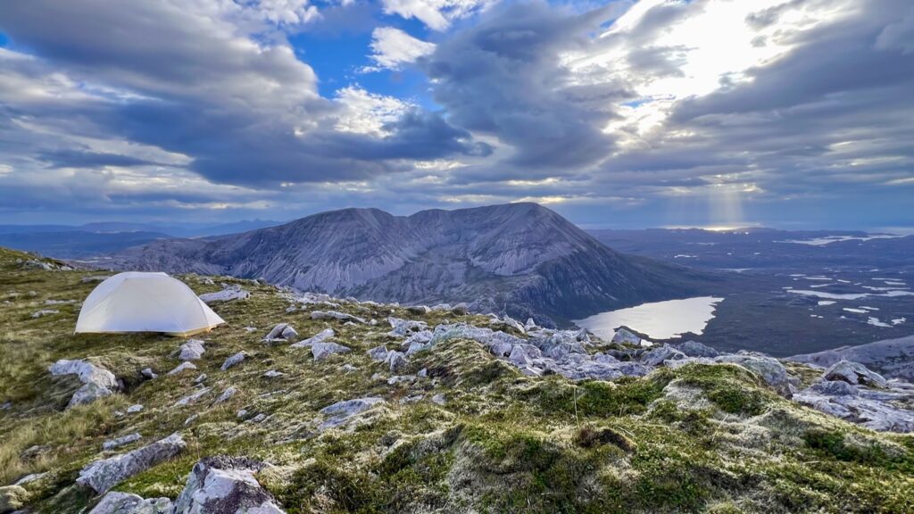
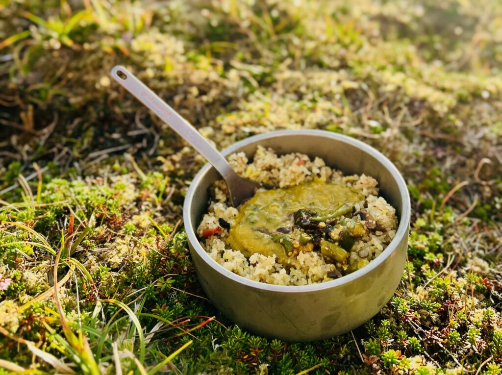
Dinner was a wild mushroom pilau with spinach and sweet potato coconut curry—both from the dehydrated food larder. Topped with chilli and aubergine pickle, and served with that view… it was awesome.
Day 1 Gallery

")
")
")
")
")
")
")
")
")
")
")
")
")
")
")
")
")
")
")
")
")
")
")
")
")
")
")
")
")
")
")

")
")
")
")


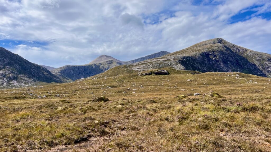
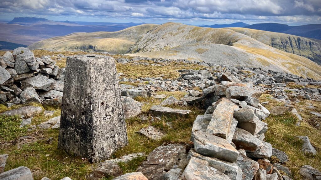
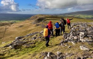
Day 2: The quiet Corbetts and Fiona’s of North Assynt – ~17km
I set off from my idyllic lochan-side camp for a very different kind of mountain day. Gone was the drama of Foinaven’s shattered ridge; day 2 was far more subtle but equally great. My goal was to reach Meallan Liath Coire Mhic Dhùghaill (“grey hill of Dougall’s corrie”), said to have the longest hill name in Scotland. A lyrical name for a remote hill that would be the culmination of a string of summits ahead.
To get there meant traversing a wild sequence of rarely visited hills:
- Meall Horn (“horn-shaped hill”),
- Sabhal Beag (“small barn”),
- Sabhal Mòr (“big barn”), and
- Meall Garbh (“rough hill” – it wasn’t really rough at all!)


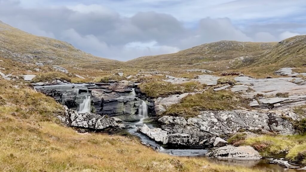
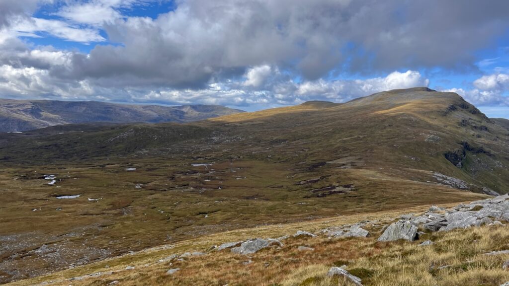
The terrain was entirely off-piste but surprisingly friendly underfoot, probably aided by the dry summer we’ve been having. Grassy ridgelines rolled into each other with a few brief stretches of quartzite boulder fields—short-lived and easily managed.
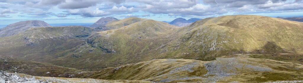
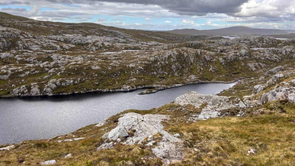
These hills may lack the theatrical grandeur of Foinaven, but their rewards are more subtle. The views were outstanding: I kept looking back to the north, Foinaven growing ever smaller; to the south, I could see Quinag and a glimpse of Suilven peaking out above the foreground hills.
There was no one else around, aside from the occasional ptarmigan. Each hill provided a superb vantage point. When I finally reached Meallan Liath Coire Mhic Dhùghaill, the wind had picked up so I didn’t linger long at the summit. It was now time to descend and find camp.
This was probably the toughest part of the day. The downhill involved boggy, tussocky, energy-sapping terrain along the Allt an Reinidh (“I’m in some kind of river bog hell”, I thought at one point). I was relieved to meet the good track that zig zags down the hillside to meet Aultanrynie.
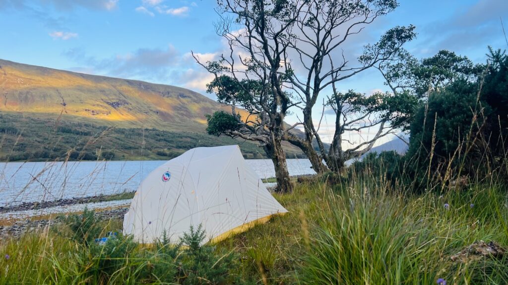
I camped up on Loch More, where there was an opportunity for a swim which I did not take. I did soak my feet (while enjoying a cup of morale boosting Heinz tomato soup) before moving on to dinner.
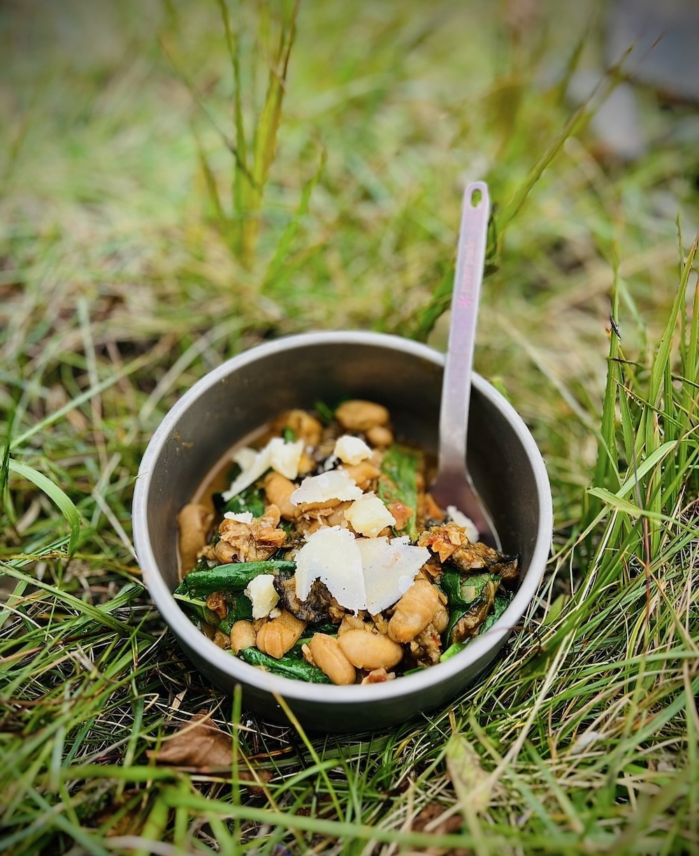
Dinner was a mushroom and aubergine cassoulet from my dehydrated food stash. It was delicious!
Day 2 Gallery
")
")
")
")
")
")
")
")


Day 3: Journey South – From the A838 to the Depths of Assynt (~25km)
This was the day I had quietly dreaded!
Not for the distance—though it was long, at around 25km—but for the great unknown: how much of a pain would it be to get from the A838 to the hills around Ben More Assynt? My original plan was wildly ambitious—carry on over Ben More Assynt and down via Breabag to the Bone Caves. But by this point, I already knew I didn’t have enough food for that kind of mileage. So I’d revised the plan: cross Glas Bheinn and link up with Quinag. But first, I had to get there.
From the road, there’s a pleasant track that leads uphill and into the bleak landscape around Beinn Leòid.
I’d climbed that hill on a previous trip, so this time I opted for a detour up Meallan a’ Chuail (“hill of the corner”), and it turned out to be a great choice. The ascent was mostly gentle, and the summit a delight!
There were clouds when I started up, but they slowly dissipated, and by the time I reached the top, I had big skies and clearer views back to where I’d been the day before and ahead towards Ben More Assynt.
I stopped for a long lunch with Lucky. He had rehydrated beef and rice; I had ribollita (one of the best uses I’ve found for leftover sourdough bread). It felt like a pause before a plunge—because from here on out, I was heading into the great unknown.
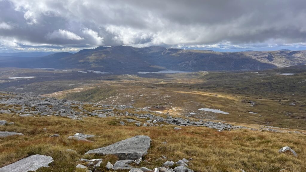
Far below I could see Gorm Loch Mòr. The OS map showed a track near this spot which led to where I wanted to be. I was determined to find this path! But between me and the path was a mess of pathless terrain that looked—and felt—like a test.
From above, I could already see the bog from hell stretching out below. But in truth, the ground around Meallan a’ Chuail was drier and friendlier than the notorious mire near Beinn Leòid—a small mercy.
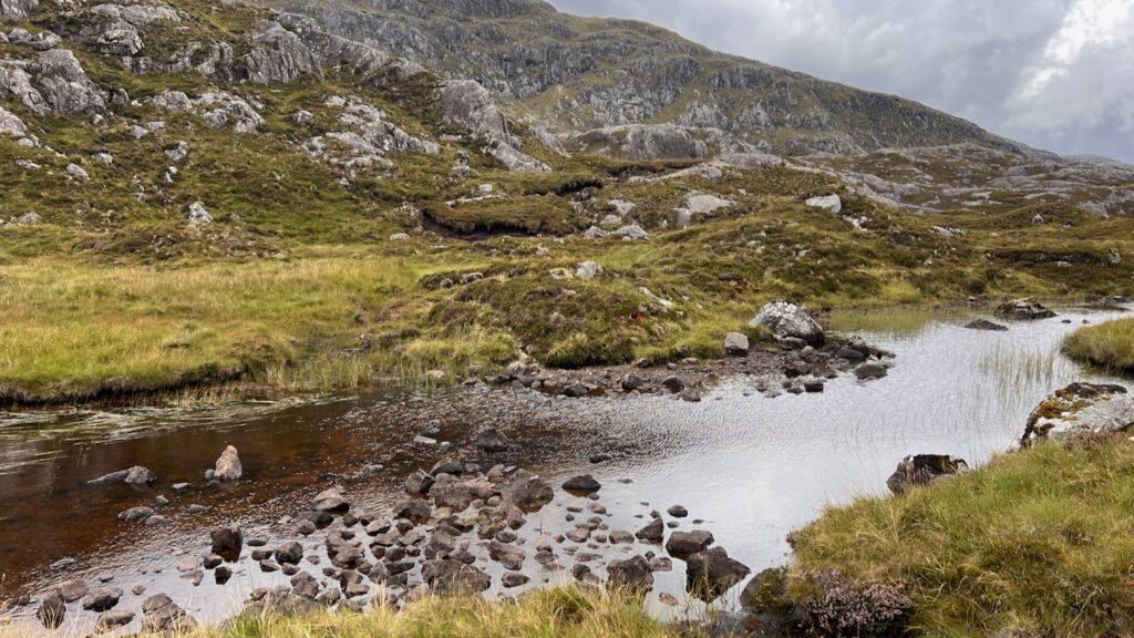
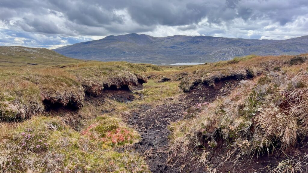
The bogs around the Fionn Allt area weren’t too bad, thanks to the dry weather, but things got gnarlier as I neared the loch. You can see it in the GPX: all the zigzags, hesitations, reroutes. Boulder fields, hidden bogs, random streams, and the eternal question: where the hell is that path?
It took nearly two and a half hours from the summit to find the infernal path. And when I finally did… well, it was barely a path. It kept disappearing, faint and overgrown, sometimes more hindrance than help. Honestly, the off-piste section had been easier.
Now deep in the heart of Assynt, I found myself surrounded by rock, Lewisian gneiss—some of the oldest rocks in Europe, over 3 billion years old. Their weathered grey outcrops twisted through the landscape and felt both timeless and slightly unsettling, as if it didn’t really want company.
I eventually reached a path junction near Eas a’ Chual Aluinn. I pitched the tent, inflated my Therm-a-Rest, put Lucky to bed, and started contemplating the evening… until the midges arrived.
They didn’t just arrive. They descended, in biblical numbers. It sounded like it was raining on the tent fabric—except it wasn’t water, it was wings.
With no phone signal, I used my Garmin InReach Mini 2 (a godsend) to message Mark and check the weather. It didn’t look good: the wind was set to drop to just 2mph overnight, with no improvement the next morning. The midge dread ran deep.
I sat in the tent, studying the map. That’s when I realised: the road wasn’t actually that far. If I packed up and moved quickly, I could be there in a couple of hours.
So the decision was made. I was out of that tent and packed up in a lightning-fast seven minutes—a personal best. Even Lucky seemed to be in mission mode. Two hours later, I saw Mark walking down the track to meet us. Knight in shining wicking breathable outdoor wear!
I was marginally disappointed to miss Glas Bheinn—but I’ve climbed it several times before so I didn’t feel like I was missing out (it’s a very worthwhile hill!). Same with the Ben More Assynt and Breabag link-up I’d planned. That, too, can wait for another time.
Day 3 Gallery


 Wild Mushroom Pilau – Dehydrated Backpacking Meal Recipe
Leave a Reply