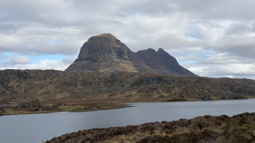
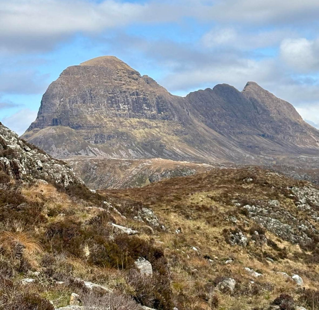
The usual way up Suilven is from Glencanisp, an approach I’ve taken many times. But a visit from friends gave us reason to try Suilven from a completely different angle — via Inverkirkaig and the Falls of Kirkaig. I’m left wondering why the Glencanisp route gets all the attention. The Kirkaig approach felt comparably more varied, and there’s something the other side can’t offer: suspense. From Glencanisp, Suilven is always there, looming over you from the start. Here, it reveals itself slowly alongside other wonderful local hills — Cul Mor, then Cul Beag, Stac Pollaidh, and beyond. Suilven finally emerges, looking utterly insurmountable and every bit the “pillar mountain” its Norse-Gaelic name suggests.
Download file for GPSNote: This GPX file is based on my own journey and intended for inspiration only. Much of the route involves off-piste terrain and will no doubt differ significantly from your own track. Always carry a map and compass and know how to use them (or sign up for a navigation course to skill up for better safer adventures!)!
Also FYI: This post contains affiliate links. If you make a purchase through one of my links, I might earn a small commission. Thanks for supporting the journey!
Trip Essentials
- Start / Finish: Inverkirkaig car park (view on Google Maps)
- Total Distance: ~23km
- Total Ascent: ~1040m
- Terrain: Reasonable path throughout (by Scottish standards). Numerous lumps and bumps on the lower ground, boggy in places.
- Maps: Assynt & Coigach Harvey Map
- View on OS Maps
- View this route and more in our Interactive Route Map
Field Notes
My friend Aileen has a monthly tent challenge — camping out somewhere new every month. Naturally, it’s a challenge I can get on board with. Last year, she and our mutual friend Charlie came up to Assynt in May and met her tent challenge with a camp around Breabag. We had a blast and immediately started planning a repeat — a new tradition. So we set our sights on Suilven, that iconic Assynt mountain and one of Charlie’s favourites.
I had it in my head that our dates coincided with the local “Race to the Base” Half Marathon, which would see the popular Glencanisp side of Suilven busy with runners — a sure way to kill the vibe we were going for. So I suggested we try the Inverkirkaig approach instead, something totally new to me but which I’d always wanted to do. The irony is that I got my dates wrong and Race to the Base was happening a week later — but it’s just as well, because we wouldn’t have done this otherwise.
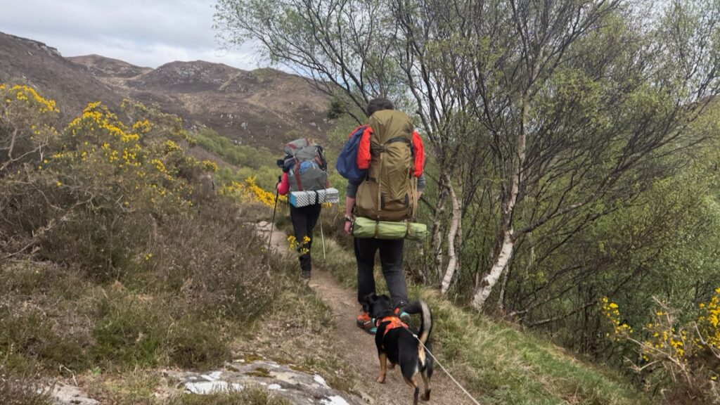
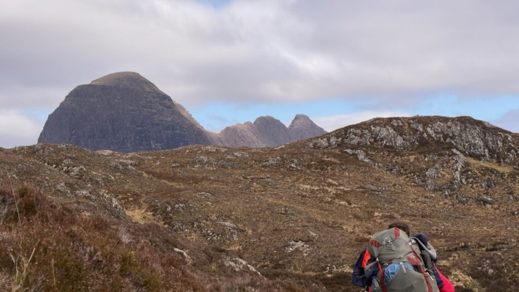
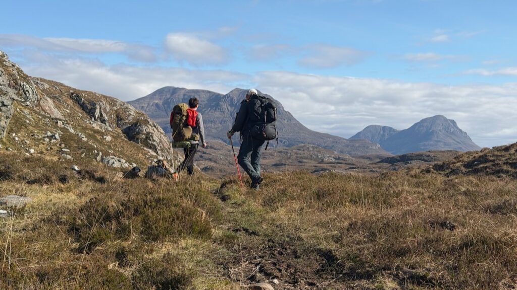
We departed on the Sunday afternoon in fine conditions, following the path along the River Kirkaig. Parts of it were lined with bright yellow gorse bushes oozing their coconut scent. As we neared Kirkaig Falls, the surrounding Assynt hills began to come into view — first Cul Mor and Cul Beag, and then the punchline: Suilven, looking insurmountable. Gotta love a slow reveal.
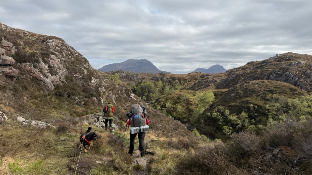
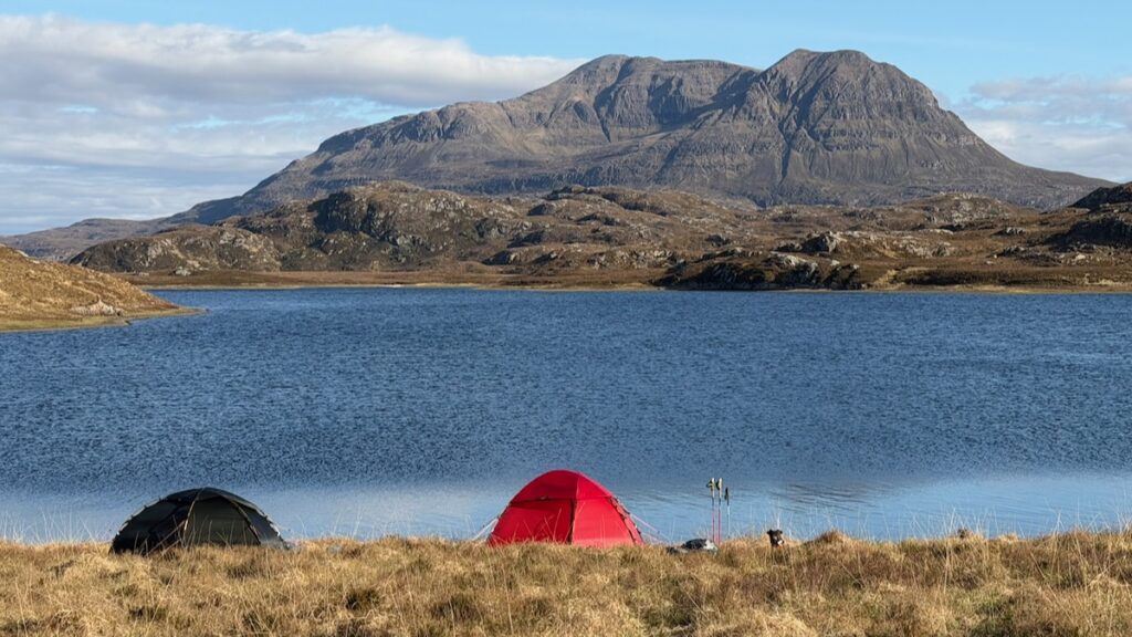
As it was late in the day we decided to save Kirkaig Falls for the following morning, and carried on towards Fionn Loch. Things get boggier from here, but the path stays obvious and wild camping spots are plentiful. We rounded the loch and walked a couple more kilometres to find a pitch near the indicated path up Suilven.
This was one of the best wild camps I’ve experienced in terms of scenery. The fair weather helped, of course — Cul Mor commanded the view from across the loch, and the top of Suilven was just visible above the surrounding hills. (Would we be able to see our tents from the summit the following day!?)
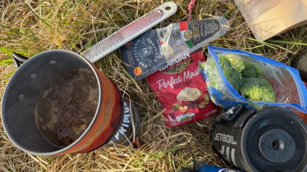
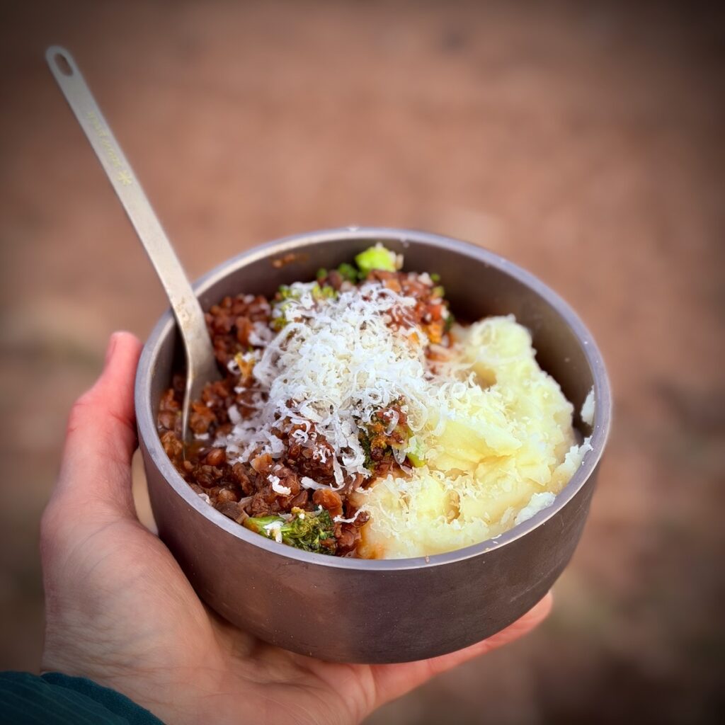
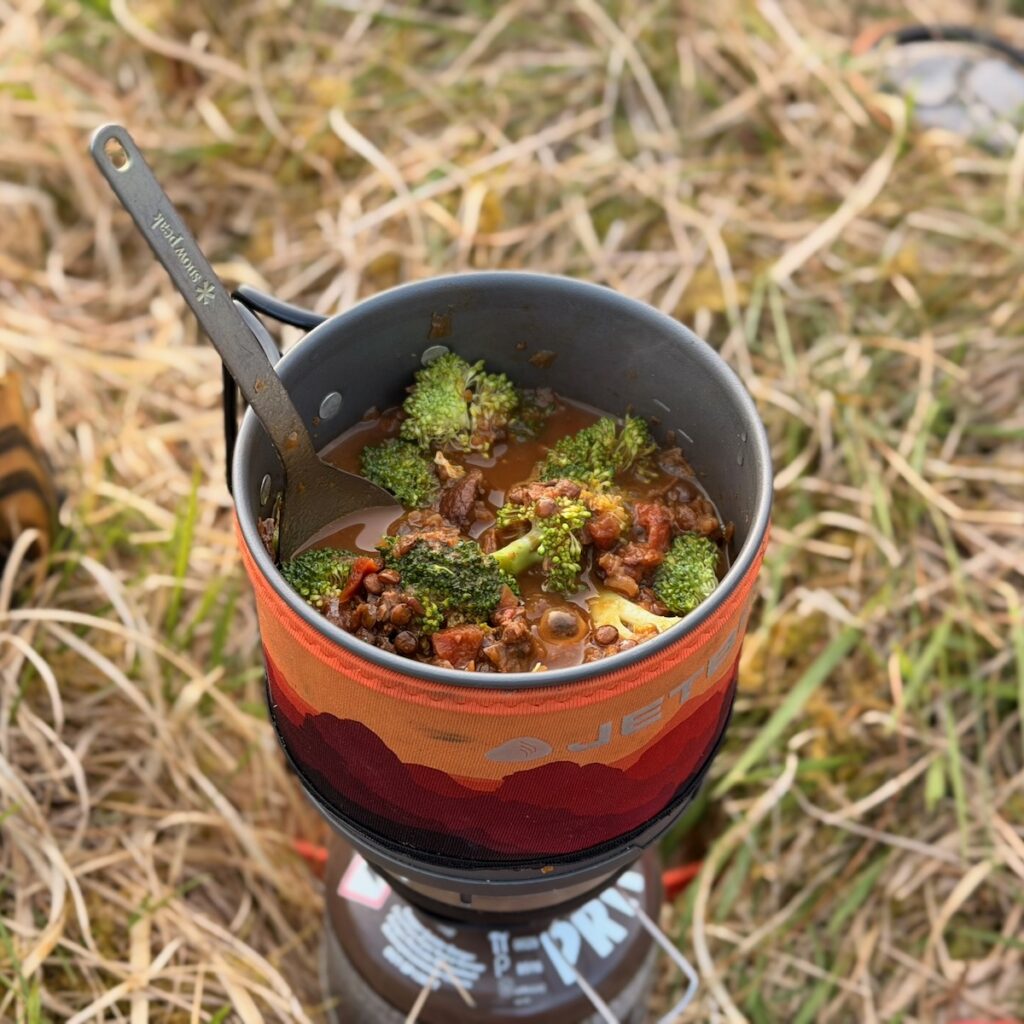
Dinner was a very special mushroom ragu, a new dehydrator experiment that I can confirm was very successful. Served with broccoli, instant mash, and parmesan cheese. Delicious!
[Side story about our own tent challenge: dealing with two dogs who are desperate to share our admittedly small sleeping bag with us! We’ve got a Big Agnes Rapid double wide sleeping bag which I love (so much so I got the single version for myself) and Sea to Summit Spark Double Sleeping Bag, which we *think* is part of the problem. The sleeping bag is snug as is, so when a dog wants to sleep on top of it, you end up in an uncomfortable cocoon. The sleeping bag also slides all over the place. So we’ve determined to revert to my old faithful option – the Big Agnes King Solomon Double Wide which I’ve owned before and absolutely loved. The newer model looks even better, and so a new shopping mission begins. I think a small sleeping mat and bag for the dogs might also help, though that could be an expensive experiment to result in me sleeping in the dog bed!]
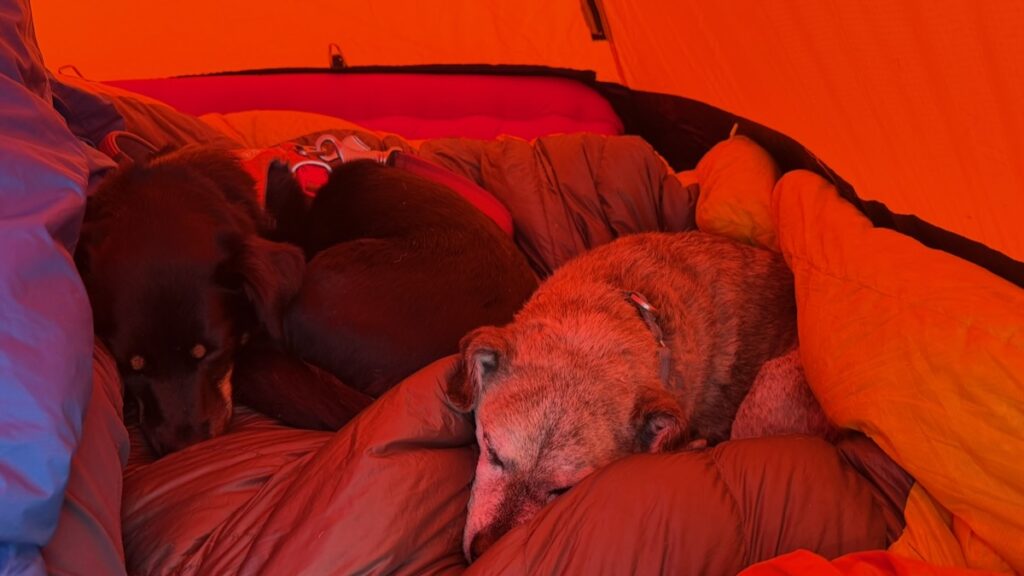
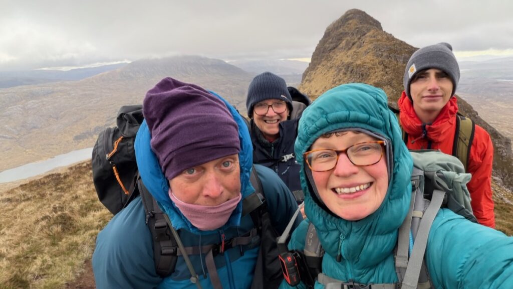
After an iffy night’s sleep — partly thanks to Lucky and Mila convinced they needed to share our sleeping bags — we got an early start, leaving the tents and most gear behind and taking only the essentials. The weather had changed. Dramatic clouds rolled over Cul Mor and Suilven was in cloud. So much for a tent view from the summit!
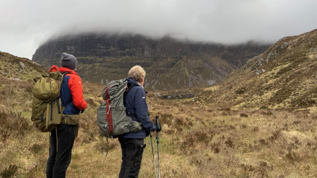
The path up this side of Suilven is unquestionably steep and slow going, though from memory not dramatically more so than the Glencanisp route (I’ll have a chance to sense-check this shortly — I have two guided hikes up Suilven at the end of May). The wind was fierce as we reached the bealach, but we were out of the cloud, and the reward of the view opening to the north was something special.
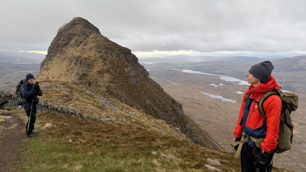
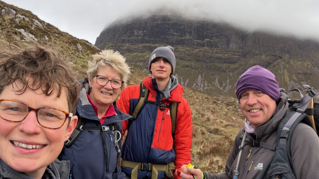
Given the conditions, only Charlie pushed on to the true summit of Caisteal Liath. The rest of us sheltered next to the dry stone wall that runs across the bealach — which, as it turns out, has a more interesting story than most people realise.
A short story about Suilven’s dry stone wall
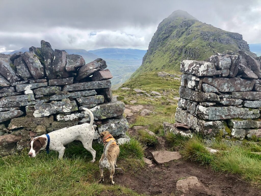
The wall is often cited as a “destitution wall” or “famine wall” — including in Google’s AI overview. But local knowledge suggests otherwise, and it’s a good reminder that AI overviews are best treated as starting points rather than final authorities, particularly for local history or contested interpretations.
The real story according to local lore seems to be quite different. Gemma Smith gives her account in Bella Caledonia:
“There is a beautifully put-together dry-stone wall across the top of Suilven itself. Stories about the origin of the wall circulated for years among hillwalkers: it was a land boundary, a poor project, a dyker showing off, a Labour of Hercules style-feat performed by a young man to win the hand of a woman in marriage. The local oral tradition had always insisted that it was a sheep-wall, designed to keep them away from the most precarious drops around Caisteal Liath. Documentary evidence supports this story – accounts show that it was built in the late 1840s for the tenant John Scobie of Glencanisp sheep farm and cost him the grand sum of £50. According to legend, John Macleod, one of the dykers, lived twelve miles away at Ardroe, and had to walk home and back every day to milk his cow. The wall was built because the new commercial Lowland sheep breeds were not as canny as the wilier wee native sheep and goats that preceded them and kept wandering off the top of the hill.”
It’s well worth reading her full article about Suilven for more history about the locality.
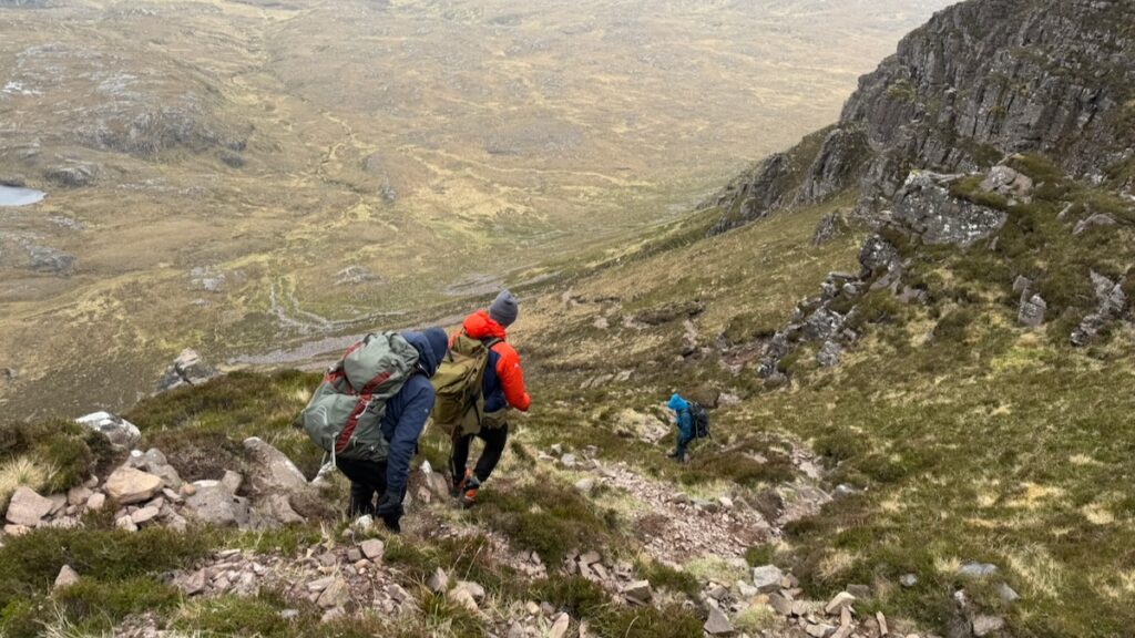
We made the slow, careful descent back down the steep path, which seemed to take an eternity as these things always do. Back at basecamp we rested, refuelled, and packed up. The walk back to the car felt longer than the walk in — a fairly classic Suilven effect in my experience.
We probably should have visited Kirkaig Falls the day before; by the time we reached the path junction on the way out, we were more interested in getting back than taking detours. It was also hard to imagine any waterfall short of Niagara topping the effect of the previous 24 hours.
We arrived back exhausted and very happy. There were lessons learned too — the usual post-trip analysis about pack weight and lighter gear (we’re all still using some legacy kit, and the bank account is not a bottomless pit). But the biggest takeaway for me was simply how worthwhile this approach to Suilven is.
A note on the name
Suilven means “Pillar Mountain,” from Norse and Gaelic: Sula (pillar) + Fjell (mountain), Gaelicised to bheinn and Anglicised to -ven. Though as Gemma Smith rightly points out, the name doesn’t really do it justice. And I agree with her on something else too: you don’t need to go to the top. And in fact, it’s often best appreciated from afar.
See also: Assynt Place Names | Dan Bailey’s write-up on Suilven via Falls of Kirkaig
Gallery


 Mushroom Traybake Ragù — Dehydrated Backpacking Meal
Leave a Reply